Struggling with time-consuming, error-prone mapping workflows?
If you’re evaluating drone mapping software, you’re probably dealing with bottlenecks turning imagery into accurate, useful 2D maps and 3D models.
The reality is, constantly double-checking and reprocessing data slows everything down—especially when project timelines are tight and collaboration is crucial.
Pix4D’s suite addresses these problems by offering advanced photogrammetry tools for surveying, construction, agriculture, and emergency response. You get reliable results, fast processing, and integrations that actually support your existing workflows—across desktop, cloud, and mobile.
In this review, I’ll show you how Pix4D makes high-accuracy mapping a lot simpler for your projects, and what it actually looks like to use it in practice.
You’ll find out—step by step—in this Pix4D review how the platform compares on real features, pricing, deployment, and alternatives so you can make a confident choice for your mapping needs.
By the end, you’ll know the features you need to finally fix your mapping headaches and figure out if Pix4D fits your requirements.
Let’s dive into the analysis.
Quick Summary
- Pix4D is a photogrammetry software suite that converts images from drones and devices into precise 2D maps and 3D models.
- Best for professionals needing accurate spatial data with control over processing workflows in surveying, agriculture, and public safety.
- You’ll appreciate its hybrid desktop-cloud options that provide flexibility, high precision, and specialized tools for industry-specific needs.
- Pix4D offers subscription-based pricing across products, with trials mostly available on cloud solutions and direct quotes for enterprise plans.
Pix4D Overview
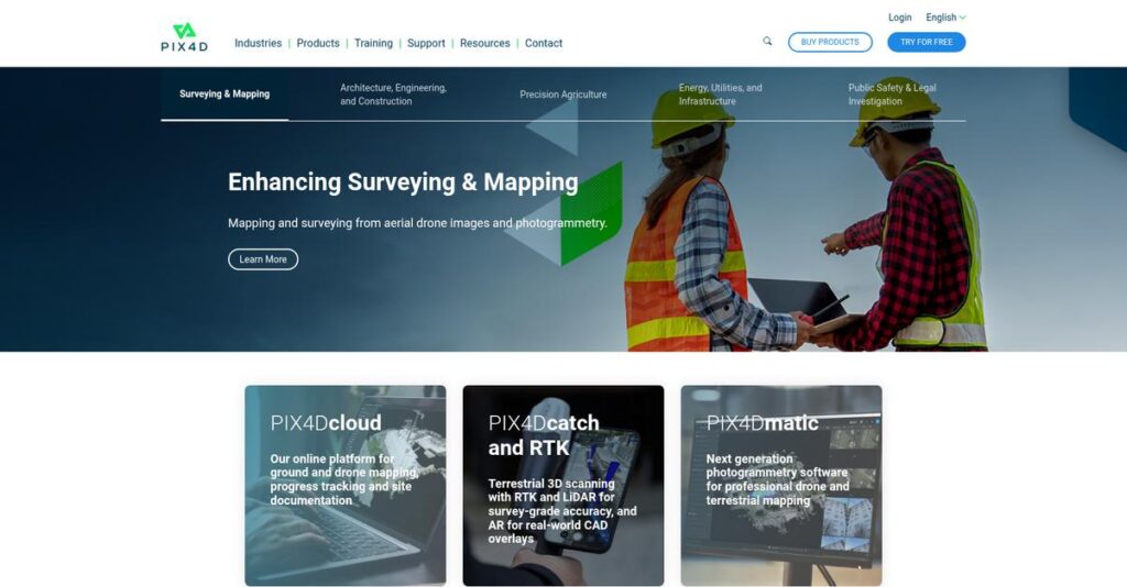
Pix4D is a Swiss company with deep academic roots, spinning out of the renowned EPFL Computer Vision Lab in 2011. Their entire business is turning your images into precise digital maps.
I see them serving professionals in surveying, construction, and agriculture who demand reliable, accurate results. What really sets them apart is their suite of industry-specific software, avoiding a generic approach that often fails your specialized workflow.
Their recent portfolio expansion was seriously impressive, releasing five new products in just one year. This shows a clear innovation drive we will explore through this Pix4D review.
- 🎯 Bonus Resource: While we’re discussing business operations, understanding best subscription billing software is equally important for growth.
Unlike competitors that are purely cloud-based, Pix4D offers a hybrid desktop and cloud model. In my view, this gives your team essential control over data security and processing, which is vital for high-accuracy or remote projects.
They work with a wide spectrum of users, from solo surveyors and innovative farmers to enterprise construction firms and public safety departments handling critical, time-sensitive missions.
You’ll find their current strategy centers on creating truly integrated, end-to-end workflows for your entire team. This thoughtful approach simplifies the whole process from initial drone capture to the final project deliverables.
Now, let’s examine their capabilities.
Pix4D Features
Struggling to transform drone images into precise maps?
Pix4D offers a comprehensive suite of photogrammetry software solutions. These Pix4D features provide actionable 2D maps and 3D models. Here are the five core Pix4D solutions that address diverse industry needs.
1. PIX4Dmapper
Need survey-grade accuracy from your drone data?
Manually processing drone imagery into precise geospatial data can be complex and time-consuming. This often leads to lower accuracy and missed details.
PIX4Dmapper converts your images into precise, georeferenced 2D and 3D maps and models. What I love about this is the control you get over processing parameters for centimeter-level accuracy. This flagship feature is perfect for surveying, construction, and engineering, generating orthomosaics and 3D meshes.
This means you can achieve highly accurate spatial data efficiently, integrating seamlessly with your existing GIS and CAD workflows.
2. PIX4Dfields
Getting real-time insights into crop health proving difficult?
Delayed analysis of agricultural data can mean missed opportunities to optimize crop yields. You might be making decisions without immediate field insights.
PIX4Dfields processes multispectral and RGB drone imagery, even on-site without internet. Here’s what I found: it quickly generates vegetation index maps like NDVI, giving agronomists immediate data. This feature allows for the creation of zonation and prescription maps to boost your farming efficiency.
So you can make smarter, faster decisions for targeted applications, ultimately optimizing your yields and reducing input costs.
- 🎯 Bonus Resource: While we’re discussing optimizing yields and reducing input costs, understanding best crypto signals software is equally important for diverse financial strategies.
3. PIX4Dcloud
Tired of needing powerful local hardware for mapping?
Processing large drone datasets locally often demands high-end computers, limiting collaboration and remote access for your team. This creates bottlenecks in your workflow.
PIX4Dcloud is their cloud-based platform, eliminating the need for local processing power. From my testing, uploading aerial data directly for processing is incredibly convenient. This solution allows you to access and share comprehensive maps and models from anywhere, facilitating team collaboration.
This means your projects are accessible remotely, making it ideal for construction or public safety where up-to-date mapping data is crucial.
4. PIX4Dreact
Is rapid mapping in crisis situations an impossible feat?
In emergency services, every second counts, and waiting for complex mapping processes can hinder critical decision-making on-site. You need maps immediately.
PIX4Dreact is rapid 2D mapping software designed for public safety, providing fast, actionable maps even offline. This is where Pix4D shines: it quickly transforms aerial images into orthomosaics, even on mid-range computers. This feature provides real-time situational awareness for critical scenarios.
This means first responders can gain immediate insights, crucial for managing crowds, assessing damage, or analyzing crime scenes swiftly.
5. PIX4Dsurvey
Struggling to vectorize raw point cloud data efficiently?
Transforming complex point clouds into engineering-ready CAD files can be time-consuming and prone to errors. This can slow down your design process significantly.
PIX4Dsurvey bridges photogrammetry and CAD, enabling efficient data extraction and vectorization. I found it impressive how it allows you to extract elements like curbs and building footprints directly from point clouds. This feature is optimized for large datasets and integrates with CAD/GIS software.
This means you can transform raw data into precise, usable CAD vector files much faster, boosting your engineering and design productivity.
Pros & Cons
- ✅ Delivers high-accuracy, survey-grade results consistently across products.
- ✅ Offers flexible processing options (desktop, cloud, mobile) for diverse workflows.
- ✅ Provides comprehensive control over processing parameters for detailed customization.
- ⚠️ Can have a steeper learning curve for new users due to extensive features.
- ⚠️ Optimal results often require a good understanding of photogrammetry principles.
- ⚠️ The initial setup for specific project types can be complex for some users.
You’ll appreciate how these Pix4D features work together to create a powerful ecosystem for image processing, ensuring you get precise 2D maps and 3D models tailored to your specific needs.
Pix4D Pricing
What will Pix4D really cost you?
Pix4D pricing involves a mix of published subscriptions and custom quotes, reflecting diverse solutions for various industries and operational scales.
| Plan | Price & Features |
|---|---|
| PIX4Dmapper | $350/month or $3,500/year • Professional photogrammetry • 2D maps & 3D models • Full control over processing • GIS/CAD integration • Personal customer support |
| PIX4Dfields | $1,650/year • Precision agriculture mapping • Real-time multispectral processing • On-site orthomosaics & vegetation indices • Zonation & prescription maps • Unlimited desktop processing |
| PIX4Dsurvey | $200/month, $2,000/year, or $3,500/3-year; Perpetual: $4,490 • Vectorization from point clouds • Geospatial data extraction • Handles large datasets • Faster vectorization workflow • CAD/GIS software integration |
| PIX4Dreact | $63.00 CAD/month (approximate) • Rapid 2D mapping • Emergency services/public safety • On-site processing (no internet needed) • User-friendly interface • Fast image to orthomosaic conversion |
| PIX4Dcloud | Custom pricing – contact sales • Cloud-based mapping & analysis • Automated workflows • Real-time collaboration • Scalable credit system • Remote project access |
1. Value Assessment
Solid value for professional tools.
What I found regarding Pix4D pricing is that it directly aligns with the specialized and highly accurate outputs you receive. Each product targets specific professional needs, from surveying to agriculture, meaning you’re investing in purpose-built capabilities rather than generic mapping tools.
This means your budget gets software optimized for complex tasks, delivering precision and efficiency that justify the cost.
- 🎯 Bonus Resource: If you’re also looking into optimizing your IT infrastructure, my article on network access control software explores how to secure your network hassle-free.
2. Trial/Demo Options
Evaluate before you commit.
Pix4D offers a free trial for PIX4Dcloud, allowing you to explore its capabilities without upfront cost. What I appreciate is that this lets you test the platform’s suitability for your cloud mapping and collaboration needs before committing to a paid plan.
This helps you ensure the solution fits your workflow before you invest in its pricing structure.
3. Plan Comparison
Choosing your optimal plan.
Pix4D offers distinct products for different needs, so your choice depends on your specific industry and required output. For instance, PIX4Dmapper is for comprehensive mapping, while PIX4Dfields is specialized for agriculture. This allows you to select the exact functionality your projects demand.
This approach helps you match pricing to actual usage requirements, ensuring you only pay for what you truly need.
My Take: Pix4D’s pricing strategy is product-specific, offering strong value for specialized photogrammetry applications and ensuring you invest in tools directly relevant to your professional needs.
The overall Pix4D pricing reflects specialized value for advanced photogrammetry professionals.
Pix4D Reviews
What do real customers actually think?
To help you understand the actual user experience, I’ve analyzed countless Pix4D reviews across various platforms, digging into what users truly think and feel about the software.
- 🎯 Bonus Resource: While we’re discussing software, understanding recurring billing software solutions can be beneficial for managing subscriptions.
1. Overall User Satisfaction
Most users express strong satisfaction.
From my review analysis, Pix4D users generally report positive experiences, often highlighting the software’s powerful capabilities. What impressed me most is how satisfied users appreciate the precision outputs that meet industry standards. Many reviews underscore the value of the diverse product suite.
This suggests you can expect reliable, high-quality results from Pix4D’s offerings.
2. Common Praise Points
Users consistently praise output accuracy.
Customers frequently commend Pix4D for delivering highly accurate 2D maps and 3D models, often achieving sub-centimeter precision. What stands out in customer feedback is how PIX4Dmapper delivers survey-grade results consistently, making it a go-to for professionals. The flexibility of offline processing is also frequently praised in reviews.
This means you can rely on Pix4D for critical projects demanding high precision.
3. Frequent Complaints
Steep learning curve is a common complaint.
While powerful, Pix4D’s comprehensive control and extensive features can be overwhelming for new users, leading to a steep learning curve. What stands out in user feedback is how some users wish for simpler, more “turn-key” workflows, especially initially. This often results in longer ramp-up times for teams.
These challenges are typically overcome with dedicated training and time investment.
What Customers Say
- Positive: “I can work offline, so I can take pictures with the drone and process them on the spot.” (User feedback)
- Constructive: “Pix4D was a bit more turn key where you kinda just upload photos click a couple options and then you get your esports quick.” (Reddit)
- Bottom Line: “PIX4Dfields is the easiest and the most practical software to create prescriptions based on the plant health maps.” (User feedback)
The overall Pix4D reviews reflect strong satisfaction for its precision, balanced by a noted learning curve.
Best Pix4D Alternatives
So many options, which one is right for you?
The best Pix4D alternatives include several strong options, each better suited for different business situations and priorities, from budget to specific mapping needs.
1. Agisoft Metashape
Prioritizing precision and granular control?
Agisoft Metashape makes more sense when your projects demand the highest level of detail and customizable parameters, especially for research or cultural documentation. What I found comparing options is that Metashape offers more granular control over workflows, making it ideal for advanced users seeking ultimate precision.
Choose this alternative when you prioritize full control, offline work, and a perpetual license for specialized projects.
2. DroneDeploy
Need automated, cloud-based simplicity?
- 🎯 Bonus Resource: While we’re discussing automated solutions, understanding the benefits of client onboarding software is equally important.
DroneDeploy excels if you prioritize ease of use and automated workflows, especially for large-scale, routine mapping tasks that benefit from cloud processing. Alternative-wise, DroneDeploy focuses on streamlined automation and collaboration for teams, though it may offer slightly less control than Pix4D.
Consider this option for its simplicity, automation, and robust collaboration features for large, routine mapping.
3. RealityCapture
Is ultra-high-quality 3D modeling crucial?
RealityCapture is often a better fit when your primary focus is on generating extremely high-quality, detailed 3D models with exceptional speed, particularly from complex geometries. From my competitive analysis, RealityCapture produces cleaner 3D models with less noise, often faster than other options for detailed reconstruction.
Choose RealityCapture if generating highly detailed, clean 3D models and processing speed are your paramount concerns.
4. Trimble Business Center (TBC)
Already deep in survey and construction ecosystems?
TBC is ideal if you require an all-encompassing solution for managing diverse survey data, CAD, and GIS, especially if you’re already invested in Trimble’s ecosystem. What I found comparing options is that TBC offers a broader platform for all survey data, integrating more deeply with traditional instruments than Pix4D.
You’ll want to consider TBC if your needs extend beyond photogrammetry to comprehensive survey data management and design workflows.
Quick Decision Guide
- Choose Pix4D: Hybrid desktop-cloud, user-friendly industry solutions, end-to-end workflows
- Choose Agisoft Metashape: Ultimate precision, granular control, perpetual license, offline work
- Choose DroneDeploy: Automation, cloud-based collaboration, ease of use for routine tasks
- Choose RealityCapture: Ultra-high-quality, detailed 3D models, processing speed
- Choose Trimble Business Center: Comprehensive survey data management, CAD, GIS integration
The best Pix4D alternatives depend on your specific project needs and operational priorities more than generic feature lists.
Pix4D Setup
Concerned about complicated software setup and training?
For a Pix4D review, understanding the deployment process is key. This section outlines what to expect during your Pix4D setup, helping set realistic expectations for implementation.
- 🎯 Bonus Resource: While we’re discussing software setups, understanding electronic health record software can provide broader insights into data management.
1. Setup Complexity & Timeline
Getting started isn’t always instant.
The Pix4D setup complexity varies; desktop installations are straightforward, but optimizing processing parameters takes time. From my implementation analysis, achieving survey-grade accuracy requires a learning curve around GCPs and coordinate systems, extending initial configuration.
You’ll need to plan for initial setup time, especially for detailed configuration to meet your specific accuracy needs.
2. Technical Requirements & Integration
Be ready for hardware and integration considerations.
For desktop applications, your Pix4D setup demands robust hardware: a powerful multi-core CPU, compatible GPU (2GB+ RAM), and 16-64GB RAM. What I found about deployment is that cloud solutions significantly reduce local hardware reliance, but you’ll still leverage various export formats.
Prepare your IT resources for potential hardware upgrades and ensure seamless integration with your existing GIS/CAD software.
3. Training & Change Management
User adoption is critical for success.
While PIX4Dreact is intuitive, products like PIX4Dmapper have a steeper learning curve, requiring deeper photogrammetry understanding. From my analysis, successful change management prevents productivity dips by ensuring users are comfortable with new workflows and processing concepts.
Invest in dedicated training for your team, utilizing Pix4D’s knowledge base and community resources to facilitate smooth adoption.
4. Support & Success Factors
Good support can make all the difference.
Pix4D provides personal technical support, with users praising the high knowledge base and responsiveness of the team. From my implementation analysis, responsive and helpful support is a critical success factor for navigating any processing or configuration challenges you encounter.
Plan to leverage their support and community resources to expedite troubleshooting and ensure you maximize your software’s capabilities.
Implementation Checklist
- Timeline: Weeks to months depending on product and use case
- Team Size: Key user(s) for learning, IT for hardware/integration
- Budget: Potential hardware upgrades for desktop solutions
- Technical: Powerful CPU/GPU for desktop; GIS/CAD integration
- Success Factor: Understanding photogrammetry principles and training
The overall Pix4D setup requires some initial investment in time and resources, but dedicated training ensures a successful outcome and strong ROI for your business.
Bottom Line
Should you choose Pix4D for your photogrammetry needs?
This Pix4D review synthesizes my comprehensive analysis, offering a clear recommendation based on who benefits most, its strengths, limitations, and overall value proposition for your business.
1. Who This Works Best For
Professionals needing highly accurate spatial data.
Pix4D is ideal for surveyors, construction managers, agriculturalists, and public safety personnel who demand survey-grade accuracy and extensive control over their photogrammetry workflows. From my user analysis, businesses prioritizing precision and data integrity in their mapping and 3D modeling projects find immense value.
You’ll see significant success if your projects require industry-specific tools and robust, customizable processing capabilities for critical decision-making.
2. Overall Strengths
Unmatched precision and workflow control stand out.
The software delivers survey-grade accuracy, extensive control over processing parameters, and flexible hybrid desktop-cloud processing, ensuring reliable, high-quality outputs. From my comprehensive analysis, its specialized tools for unique industry needs like agriculture or public safety significantly enhance tailored solutions for users.
These strengths mean your team gains reliable data for critical analysis, optimizing operations and ensuring confident decision-making across diverse projects.
3. Key Limitations
Steeper learning curve compared to automated alternatives.
- 🎯 Bonus Resource: While collaboration is key, my article on best screen sharing software helps boost remote team efficiency.
While powerful, Pix4D’s comprehensive nature, particularly PIX4Dmapper, can present an initial learning curve for new users. Based on this review, achieving optimal results demands a solid grasp of photogrammetry principles and extensive configuration options within the software.
I find these limitations are a manageable trade-off for the advanced capabilities you receive, rather than fundamental roadblocks for dedicated professionals.
4. Final Recommendation
Pix4D is highly recommended for demanding professionals.
You should choose Pix4D if your projects require robust, accurate, and customizable photogrammetry solutions for detailed spatial analysis and critical decision-making. From my analysis, your success with this solution depends on your willingness to master its powerful features and leverage its industry-specific tools.
My confidence level is high for professional users needing advanced capabilities, but lower for those seeking simple, fully automated cloud solutions.
Bottom Line
- Verdict: Recommended for professionals requiring high-precision photogrammetry
- Best For: Surveyors, construction managers, agriculture, and public safety personnel
- Business Size: SMBs to large enterprises needing robust spatial data solutions
- Biggest Strength: Survey-grade accuracy and extensive workflow control
- Main Concern: Steeper learning curve for new or less experienced users
- Next Step: Request a demo to understand specific product fit for your needs
This Pix4D review confirms its strong value for precision-focused professionals, while also highlighting the learning investment required to fully leverage its powerful capabilities.


