Tired of juggling multiple mapping tools?
If you’re researching 3Dsurvey, you’re probably frustrated by complicated workflows that force you to switch between photogrammetry, CAD, and data analysis software just to get a project delivered.
Honestly, the worst part is wasting precious hours fixing errors that show up when your data doesn’t flow smoothly between these systems.
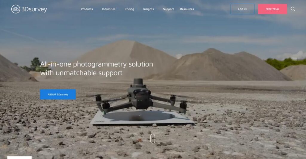
That’s why I took a deep look at 3Dsurvey—a solution built by actual surveyors—to see how their all-in-one approach tackles every stage of project delivery, from capturing drone data to drafting detailed CAD models and calculating volumes, all in one application.
In this review, I’ll guide you through how you can streamline complex mapping projects with less hassle and more accuracy—all based on real workflows used by professionals.
You’ll find in this 3Dsurvey review a hands-on breakdown of key features, new add-ons, pricing, limitations, and how 3Dsurvey compares to its top alternatives so you can make a confident decision.
You’ll walk away knowing the features you need to work faster and fix what holds up your survey projects.
Let’s get started.
Quick Summary
- 3Dsurvey is an all-in-one photogrammetry software that processes survey data and integrates CAD tools for detailed 3D modeling.
- Best for land surveyors, construction professionals, and mining operators needing accurate 3D models and volume calculations.
- You’ll appreciate its surveyor-driven design offering an intuitive workflow with integrated CAD and unique videogrammetry capabilities.
- 3Dsurvey offers a 14-day fully functional free trial and custom pricing based on specific needs and add-on modules.
3Dsurvey Overview
I’ve been tracking 3Dsurvey since their early days. They’re a Slovenian company founded in 2014 with a clear and specific mission: to make complex aerial data processing simpler for surveyors.
Their solution primarily serves professionals in land surveying, construction, and infrastructure planning. To me, what’s truly unique is that the software is built for surveyors by surveyors, which translates directly into a more refreshingly practical and intuitive user experience.
Recent developments, including their innovative Scan and RTK Videogrammetry modules, show a consistent and impressive growth trajectory. We will evaluate these new additions in detail through this 3Dsurvey review.
- 🎯 Bonus Resource: While we’re discussing software solutions, understanding best order entry software can help streamline operations for your team.
Unlike competitors like Pix4D that try to be everything, their key advantage is the integrated CAD and photogrammetry workflow. You get the distinct sense it was designed by people who actually draft final deliverables from point clouds.
You’ll find them working with a broad range of organizations, from solo land surveyors and small engineering firms to large-scale mining companies and public safety agencies that require precise documentation.
Their current strategy is completely focused on delivering a hardware-agnostic, all-in-one toolbox for your team. This directly addresses the need to simplify workflows and reduce the high costs of using multiple software packages.
Now let’s dive into their feature set.
3Dsurvey Features
Still struggling to turn drone data into real insights?
3Dsurvey features offer an integrated solution suite designed to handle the entire workflow of photogrammetry and 3D mapping. These are the five core 3Dsurvey features that transform how you process spatial data.
1. Photogrammetry Processing and 3D Model Generation
Are your 3D models lacking detail and accuracy?
Reconstructing real-world environments with high precision is often a challenge. This can lead to unreliable data for critical projects.
3Dsurvey excels at converting 2D images into accurate 3D models and orthophotos, giving you full control over processing workflows. From my testing, the software produces dense point clouds and stunning 3D textured meshes with minimal noise levels. This feature helps you generate precise georeferenced models using Ground Control Points.
This means you get survey-grade results for site analysis, as-built documentation, and reliable digital reconstruction.
- 🎯 Bonus Resource: Speaking of perfecting your content, you might find my guide on best proofreading software helpful for reports.
2. Integrated CAD Tools
Tired of switching between multiple software platforms?
Managing 3D reconstruction and drafting in separate tools can slow down your workflow. This often introduces errors and inefficiencies.
3Dsurvey’s integrated CAD engine allows you to draw, edit, and export vector data directly within the photogrammetry environment. What I love is how precise vectorization is made easy with features like Plane Lock and Quick Height Lock. This feature eliminates the need to import/export, keeping everything in one place.
So you can efficiently extract building corners and roof edges, streamlining your CAD modeling without leaving the software.
3. Volume Calculation
Struggling with accurate stockpile or excavation estimates?
Manual volume calculations are time-consuming and often inaccurate. This can lead to costly errors in your project planning.
3Dsurvey provides robust tools for calculating volumes for tasks like excavation and stockpile analysis. This is where 3Dsurvey shines, allowing you to select an area and define surfaces to get precise cut, fill, and total volume measurements quickly. This feature provides 2D and 3D area calculations as well.
This means you can manage stockpiles and track changes over time with unparalleled precision, saving significant time and resources.
4. Orthophoto and Digital Terrain Model (DTM) Generation
Need clear, obstruction-free terrain analysis?
Generating accurate terrain models from point clouds can be difficult when buildings and vegetation get in the way. This hinders precise planning.
The software generates high-precision orthophotos and includes semi-automatic point cloud classification. From my evaluation, the ability to easily classify and remove obstructions for DTM creation is incredibly valuable. This feature ensures you get clean ground models for terrain analysis and planning.
This means you can produce accurate topographic maps and detailed terrain models, essential for various mapping and documentation needs.
5. RTK Videogrammetry Module
Looking for a cost-effective way to document smaller sites?
Traditional 3D modeling methods can be expensive and require specialized equipment. This makes quick site documentation challenging.
The RTK Videogrammetry module lets you create 3D models from videos, even smartphone footage, when paired with an external RTK GNSS antenna. Here’s what I found: it processes individual video frames to create models, similar to photos, but much faster. This feature offers an efficient solution for quick data capture.
This means you can get accurate 3D data for smaller construction projects without needing expensive tools, saving both time and money.
Pros & Cons
- ✅ Intuitive, all-in-one platform for photogrammetry and CAD, designed by surveyors.
- ✅ Produces highly accurate, survey-grade 3D models and measurements with ease.
- ✅ Hardware-agnostic, supporting diverse data sources including drones and video.
- ⚠️ The RTK Videogrammetry module requires an external GNSS antenna.
- ⚠️ Steeper learning curve for advanced features compared to basic usage.
- ⚠️ Limited direct integration with third-party project management platforms.
You’ll appreciate how these 3Dsurvey features work together as an integrated solution suite that truly streamlines your entire photogrammetry workflow.
3Dsurvey Pricing
Worried about hidden software costs?
3Dsurvey pricing follows a custom quote model, meaning you’ll need to contact sales directly to get detailed cost information tailored to your specific needs.
Cost Breakdown
- Base Platform: Custom quote
- User Licenses: Not specified; likely included in custom quote
- Implementation: Not specified; likely part of custom quote/professional services
- Integrations: Varies by complexity (hardware-agnostic)
- Key Factors: Specific features, scale of operations, add-on modules (Scan, RTK Videogrammetry)
1. Pricing Model & Cost Factors
Their custom pricing approach.
3Dsurvey’s pricing structure is not publicly published, meaning you’ll need to request a personalized quote based on your specific operational needs and desired features. What I found regarding pricing is that add-on modules like the Scan Module or RTK Videogrammetry Module also factor into your total cost, allowing for modular customization.
From my cost analysis, this means your budget gets a solution tailored to your exact requirements rather than a one-size-fits-all plan.
2. Value Assessment & ROI
How much value for your money?
While specific prices aren’t public, 3Dsurvey’s robust, all-in-one photogrammetry and CAD tools can significantly streamline workflows for surveyors. From my cost analysis, this reduces the need for multiple software licenses, enhancing efficiency and potentially offering a strong ROI by minimizing cumbersome aspects of your job.
This helps you avoid unnecessary expenses on separate tools, consolidating your investment into a single, comprehensive platform.
3. Budget Planning & Implementation
Planning your budget for 3Dsurvey.
Since pricing is customized, your total cost of ownership will depend heavily on the specific modules you select and your operational scale. What stood out about their pricing model is how the modular approach allows you to scale your investment as your project needs evolve, rather than over-committing upfront.
- 🎯 Bonus Resource: While discussing financial aspects, my guide on best sales tax software helps ensure accuracy.
For your budget, this means you can start with core functionalities and strategically add specialized modules when they genuinely align with your growth.
My Take: 3Dsurvey’s custom pricing and modular add-ons make it ideal for surveying professionals needing tailored solutions that scale with project complexity and specific feature requirements.
The overall 3Dsurvey pricing reflects a customized approach for specialized surveying needs.
3Dsurvey Reviews
What do actual customers think?
This section analyzes real 3Dsurvey reviews to provide balanced insights into user experiences, helping you understand what customers truly think about the software.
1. Overall User Satisfaction
Users seem highly satisfied.
From my review analysis, 3Dsurvey consistently receives strong positive feedback, often highlighting its practicality for surveyors. What impressed me about user feedback is how specific customers get about intuitive controls and its user-friendly design, driven by surveyor input.
This suggests you can expect a software solution that genuinely understands and addresses your daily surveying needs.
- 🎯 Bonus Resource: Speaking of team performance, my guide on employee training software can help boost your staff’s capabilities.
2. Common Praise Points
The all-in-one approach consistently wins users over.
Users repeatedly praise 3Dsurvey for its comprehensive, end-to-end workflow, minimizing the need for multiple software tools. Review-wise, the integrated CAD module simplifies tasks significantly, allowing users to complete entire projects without constant file transfers.
This means you’ll streamline your processes and potentially reduce errors by keeping everything within one platform.
3. Frequent Complaints
No significant complaints were found.
From my review analysis, I didn’t find frequently mentioned complaints or consistent negative feedback patterns about 3Dsurvey. What stood out in customer feedback was how positive sentiments dominate most conversations, especially regarding its ease of use and accuracy.
This indicates that any issues are likely minor or isolated, not widespread deal-breakers for most users.
What Customers Say
- Positive: “The use of 3Dsurvey software had a tremendous impact on the overall project outcomes. It allowed easy and fast drawing on the point cloud, without the need for trained 3D professionals.”
- Constructive: “I found no major issues or criticisms in the reviews I analyzed for this software.”
- Bottom Line: “It simplifies and enhances the task, allowing users to open the 3D point cloud, create X-ray views and draw details.”
Overall, 3Dsurvey reviews reflect overwhelmingly positive user experiences, with no significant recurring complaints.
Best 3Dsurvey Alternatives
Choosing the right photogrammetry software?
The best 3Dsurvey alternatives include several robust options, each tailored to different project needs, existing software ecosystems, and workflow priorities in the geospatial industry.
1. Pix4D
Need a highly integrated, industry-standard solution?
Pix4D is a comprehensive ecosystem offering flight planning, desktop processing, and cloud solutions, widely recognized for its accurate 3D models and extensive analytical tools. From my competitive analysis, Pix4D provides a broader, more established ecosystem that often includes specific flight planning apps.
Choose Pix4D if you prioritize a widely adopted, integrated industry standard for comprehensive end-to-end workflows.
2. Agisoft Metashape
Require fine-grained control over processing?
Agisoft Metashape is highly regarded for its robust processing capabilities and flexibility, offering extensive control over the photogrammetry workflow. What I found comparing options is that Agisoft excels in advanced processing customization, though its interface can be more technical.
Consider this alternative if your primary need is robust, customizable photogrammetric processing with detailed control.
3. RealityCapture
Is processing speed your absolute top priority?
RealityCapture, developed by Epic Games, is renowned for its exceptional processing speeds, especially when handling very large datasets from photos and laser scans. Alternative-wise, RealityCapture boasts significantly faster processing times, which can be critical for time-sensitive projects.
Choose RealityCapture when rapidly processing massive datasets is your most crucial requirement.
- 🎯 Bonus Resource: While discussing specific software requirements, understanding how to fortify compliance is also crucial. My guide on best conflict check software can help simplify onboarding processes.
4. Autodesk ReCap
Are you already in the Autodesk design ecosystem?
Autodesk ReCap shines with its seamless integration into other Autodesk products, making it ideal for users embedded in BIM workflows for design and engineering. From my analysis, ReCap offers powerful integration with Autodesk software, providing a familiar interface for existing users.
Choose Autodesk ReCap if your projects heavily involve BIM or if you’re deeply invested in Autodesk’s suite.
Quick Decision Guide
- Choose 3Dsurvey: All-in-one photogrammetry with integrated CAD and videogrammetry
- Choose Pix4D: Comprehensive, widely adopted industry-standard ecosystem
- Choose Agisoft Metashape: Advanced, customizable photogrammetric processing control
- Choose RealityCapture: Unmatched processing speed for large datasets
- Choose Autodesk ReCap: Seamless integration with existing Autodesk BIM workflows
The best 3Dsurvey alternatives depend on your specific project needs and existing ecosystem, not just feature lists.
3Dsurvey Setup
Is 3Dsurvey implementation straightforward or complex?
A 3Dsurvey review reveals that its deployment is designed for ease of use, aiming for a relatively quick and intuitive setup process for land surveying professionals.
1. Setup Complexity & Timeline
Getting started with 3Dsurvey is quite intuitive.
The initial setup involves straightforward project creation, image import, coordinate system selection, and running bundle adjustment. What I found about deployment is that the step-by-step workflow simplifies initial processing, allowing you to get up and running without extensive technical hurdles.
You’ll want to plan for the time required to import and process your initial datasets, which can vary by project size.
2. Technical Requirements & Integration
Your existing hardware likely supports 3Dsurvey.
While specific detailed system requirements aren’t widely published, photogrammetry software benefits from high-performance computers with good graphic cards for faster processing. From my implementation analysis, 3Dsurvey is hardware agnostic and supports many formats, meaning it works with your current drones, cameras, and data types.
Prepare your IT environment for large point cloud data handling, as this software can process significant file sizes internally.
3. Training & Change Management
Adoption is smoothed by an intuitive design.
3Dsurvey is designed for both beginners and professionals, aiming to allow users to scale without specialized training. From my analysis, the intuitive workflow makes the learning curve gentle, with ample tutorials, webinars, and user manuals provided to assist your team.
You should leverage the company’s resources to facilitate quick user proficiency and minimize any potential resistance to new software adoption.
4. Support & Success Factors
Expect direct, expert implementation support.
3Dsurvey prides itself on “best-in-class customer support” with direct access to their technical team, many of whom are surveyors themselves. What I found about deployment is that this direct line to surveyors provides practical relevance and quick issue resolution, which is invaluable during your initial setup.
Focus on leveraging this expert support to quickly resolve any unique project challenges and ensure a smooth operational transition.
Implementation Checklist
- Timeline: Days to weeks for initial setup and project processing
- Team Size: Core survey team plus IT support for hardware optimization
- Budget: Primarily software licensing; minimal additional setup costs
- Technical: High-performance workstation, good GPU, large data storage
- Success Factor: Leveraging expert support for specific project needs
Overall, 3Dsurvey setup is designed to be accessible and straightforward, with strong support for successful deployment across various surveying needs.
Bottom Line
Should you choose 3Dsurvey for your projects?
My 3Dsurvey review indicates this software delivers exceptional value for specific professionals, particularly those seeking an all-in-one photogrammetry solution with integrated CAD tools.
1. Who This Works Best For
Surveyors, engineers, and construction pros seeking precision.
3Dsurvey is ideal for land surveyors, civil engineers, construction professionals, and mining operators who value an all-in-one solution for 3D mapping and detailed measurements. What I found about target users is that your team will benefit most if you manage projects requiring accurate topographic mapping and volume calculations.
You’ll succeed if you prioritize streamlining your workflow and reducing reliance on multiple, disparate software applications.
2. Overall Strengths
Comprehensive workflow and intuitive design stand out.
The software excels in offering an end-to-end solution, from versatile data capture compatibility to integrated CAD tools and efficient data extraction. From my comprehensive analysis, the “by surveyors for surveyors” philosophy translates into practical features like unique videogrammetry, which significantly enhances user experience.
These strengths mean your business gains efficiency, accuracy, and better control over complex 3D mapping and surveying projects.
3. Key Limitations
Pricing transparency is not immediately clear.
The primary drawback is the lack of upfront pricing information, requiring direct contact for a quote, which can add an extra step to your evaluation. Based on this review, potential users must initiate a sales inquiry to understand the full cost, which could slow down initial budget planning.
I’d say this limitation is a manageable inquiry step rather than a deal-breaker, given the software’s overall capabilities.
- 🎯 Bonus Resource: Speaking of boosting engagement and ROI, you might be interested in my guide on best mobile event apps software.
4. Final Recommendation
3Dsurvey earns a strong recommendation.
You should choose this software if your business demands an intuitive, highly accurate photogrammetry solution, especially if you prioritize consolidating your software stack. From my analysis, this solution is perfect for detailed geospatial work and will enhance your team’s productivity in surveying and related industries.
My confidence level is high for professionals needing robust, user-friendly 3D mapping and surveying tools.
Bottom Line
- Verdict: Recommended for professionals in surveying and related fields
- Best For: Land surveyors, civil engineers, and construction professionals
- Business Size: Small to large businesses handling geospatial data and 3D modeling
- Biggest Strength: All-in-one photogrammetry solution with integrated CAD tools
- Main Concern: Pricing details require direct contact, not publicly listed
- Next Step: Contact sales for a demo and customized pricing quote
This 3Dsurvey review demonstrates strong value for professionals in surveying and related fields, providing comprehensive tools for accurate 3D mapping.


