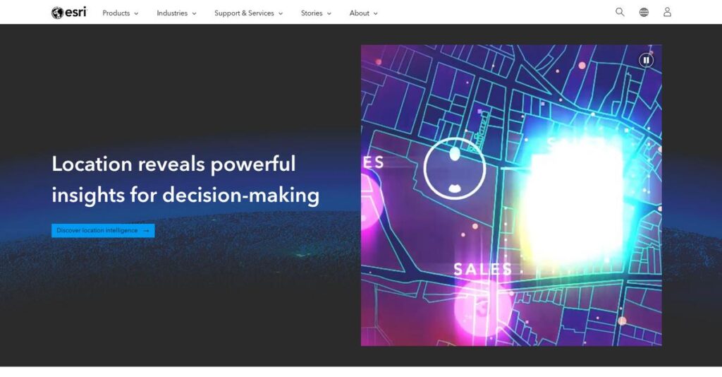
Still struggling to make sense of your maps?
If you’re looking to bring clarity to complex geographic data, evaluating Esri is likely on your to-do list.
But here’s the catch: Wasting hours wrangling disconnected spatial data is actually costing you productivity and leaving key decisions in limbo.
Esri tackles this head-on with their integrated ArcGIS suite—covering everything from high-powered desktop analytics to cloud-based sharing, real-time field maps, and even story-driven communication—helping you extract real value from your location data without heavy lifting.
In this review, I’ll break down how Esri transforms messy spatial workflows into actionable insights, so you can deliver results that actually move your business forward.
You’ll find everything you need to make an informed choice in this Esri review—from must-have features and pricing clarity to hands-on comparison with top alternatives.
You’ll walk away knowing exactly which features you need to break through bottlenecks and drive smarter decisions.
Let’s get started.
Quick Summary
- Esri is a leading GIS platform providing powerful tools for spatial data capture, analysis, and visualization across desktop, cloud, and mobile environments.
- Best for enterprise organizations needing in-depth geographic analysis and secure, scalable mapping solutions.
- You’ll appreciate its integrated ArcGIS ecosystem that supports complex workflows with strong community and industry-standard support.
- Esri offers a range of user-based subscriptions with a complex pricing structure, including affordable personal use options and enterprise-level pricing requiring direct quotes.
Esri Overview
Esri has been around since 1969, based in Redlands, California, with a mission centered on providing geographic information system (GIS) software to help users analyze and visualize spatial data. They focus on making complex geographic insights accessible for practical problem-solving.
What sets them apart is how they serve mid-market and enterprise organizations especially in government, utilities, environmental management, and commercial sectors. Their strength lies in delivering an integrated ecosystem that supports everything from desktop GIS to cloud collaboration and mobile data collection.
The recent launch of ArcGIS Reality and deeper partnerships with Microsoft demonstrate a clear innovation trajectory. The ArcGIS Online expansion and SaaS shift show why you’ll often see the term “Esri review” tied to cloud and 3D mapping capabilities.
- 🎯 Bonus Resource: While we’re discussing geographic insights, understanding online proofing software is equally important for creative workflows.
Unlike competitors like QGIS or CARTO, Esri emphasizes a comprehensive, commercially supported GIS platform that balances depth with accessibility. You’ll notice they’re not just about mapping, but the entire workflow from data collection to storytelling.
They work with a broad range of organizations, including government agencies, utilities, and global corporations, often managing massive datasets and critical infrastructure.
Esri’s current focus on cloud-native solutions and integration with business analytics aligns well with how buyers want location intelligence embedded into daily operations.
Now let’s examine their capabilities.
Esri Features
Tired of juggling separate GIS tools and workflows?
Esri solutions offer a comprehensive suite centered on the ArcGIS system, combining desktop, cloud, mobile, and storytelling tools. These are the five core Esri solutions that bring powerful spatial analysis, collaboration, and data collection into one ecosystem.
1. ArcGIS Pro
Complex spatial analysis slowing you down?
GIS professionals often struggle with limited tools that can’t handle deep data processing or high-quality map creation. That bottleneck affects decision-making.
ArcGIS Pro is a heavyweight desktop solution that handles multi-step geoprocessing, advanced data editing, and publication-ready cartography. From my testing, its integration with ArcGIS Online is a standout, letting you easily publish web maps. This feature provides professionals with unmatched analytical depth and precision for spatial tasks.
This means you get reliable, powerful software for everything from detailed analysis to presentation-ready outputs.
2. ArcGIS Online
Sharing geographic data shouldn’t be a headache.
Without accessible cloud tools, teams waste time emailing large files or dealing with version confusion, slowing projects down.
ArcGIS Online solves this by acting as a cloud-based hub where your team can publish, share, and interact with maps or dashboards via any browser. Here, the solution’s ease-of-use shines — non-experts can also engage with data, breaking down collaboration barriers across your organization.
So you get smoother teamwork and real-time updates that keep your projects moving forward effortlessly.
- 🎯 Bonus Resource: Speaking of streamlining operations, you might also find my guide on best chit fund software insightful.
3. ArcGIS Enterprise
Worried about data security and control?
Some businesses need GIS capabilities but can’t rely on public cloud services due to compliance or performance concerns, leading to stalled GIS adoption.
ArcGIS Enterprise offers a self-hosted GIS solution that you install on your servers, maintaining full control over your spatial data and services. From my testing, its flexibility and security controls make it perfect for industries like government or utilities. This solution provides complete data sovereignty while delivering web GIS capabilities comparable to the cloud.
This means you protect sensitive information without sacrificing the power of modern GIS workflows.
4. ArcGIS Field Maps
Field data collection still stuck on paper forms?
Paper-based workflows bring errors, delays, and frustration for your mobile teams, impacting data quality and project timelines.
Field Maps is a mobile solution that gives crews easy access to maps and real-time data collection tools on their smartphones or tablets. What I love about this solution is how it allows seamless syncing of street-level observations back to the office, complete with photos and location tags. This feature improves accuracy enormously.
This will save your team hours of manual work and brings instant operational insight from the field.
5. ArcGIS StoryMaps
Data reports can be boring and hard to digest.
Communicating complex maps and geographic findings to non-technical colleagues often leads to confusion and disengagement.
StoryMaps is a narrative solution that lets you craft interactive, story-driven presentations blending maps, text, images, and video. Here’s what I found: it’s incredibly intuitive and transforms dense data into compelling stories your audience actually wants to explore. This feature turns raw GIS data into engaging visual storytelling that resonates with stakeholders.
This means your insights get noticed, understood, and acted upon more effectively.
Pros & Cons
- ✅ Powerful end-to-end GIS workflows across desktop and cloud
- ✅ Real-time field data collection improves operational accuracy
- ✅ Intuitive storytelling tools boost stakeholder engagement
- ⚠️ Steep learning curve, especially for novice users
- ⚠️ High licensing costs and complex credit system
- ⚠️ Resource-intensive desktop app requires strong hardware
These Esri solutions work together as a tightly integrated GIS ecosystem that covers analysis, sharing, mobile data, and storytelling, giving your organization comprehensive spatial capabilities.
Esri Pricing
Confused about what Esri really costs?
Esri pricing is complex and mostly custom, relying on tailored quotes rather than published rates. Their multi-layered model uses user types and consumption credits, so understanding how pricing works helps you budget smarter for GIS software expenses.
Cost Breakdown
- Base Platform: Custom quote, often starting in the tens of thousands
- User Licenses: $100/year for Personal Use; $350–$3,800/year per user for professional types
- Implementation: Varies widely, typically significant for Enterprise
- Integrations: Varies by project complexity
- Key Factors: User type, usage credits, deployment scale, data storage, services consumed
1. Pricing Model & Cost Factors
Esri’s pricing is highly customizable.
Their pricing model charges you based on different user types—ranging from Personal Use at $100/year to professional licenses costing up to $3,800/year. Plus, your usage of ArcGIS Online credits directly affects costs. This multi-layered structure gives you flexibility but adds complexity. Budget-wise, it means your GIS expenses will depend largely on how many users and credits your projects consume.
This means you need to plan carefully to avoid budget surprises in your Esri pricing.
2. Value Assessment & ROI
Does this pricing justify itself?
Esri stands out by offering industry-leading GIS tools with deep analytical power and cloud collaboration. The pricing reflects that with tailored licenses and pay-as-you-go credits allowing you to pay only for what you consume. From my cost analysis, this helps businesses avoid overpaying for unused capabilities while enabling scalable growth.
For your situation, this means your budget gets premium GIS functionality with room to adjust as demand changes.
- 🎯 Bonus Resource: While we’re discussing managing your expenses, my article on dairy management software provides insights into maximizing farm profits.
3. Budget Planning & Implementation
Watch for extra cost factors.
Beyond license fees, the arc of Esri pricing includes potentially significant implementation expenses, especially for ArcGIS Enterprise users requiring on-premise setups. You’ll also pay for additional credits if your data storage or analysis needs grow. Understanding hidden costs is key to mastering total cost of ownership for your GIS environment.
So for your business size, you must factor in these variables to forecast your true Esri investment.
My Take: Esri pricing is geared toward organizations needing powerful, flexible GIS solutions with customizable user licensing and consumption costs. This approach fits mid-market to enterprise buyers ready for tailored deployments rather than simple plans.
Overall, Esri pricing delivers customized GIS value with attention to your specific needs.
Esri Reviews
Can you trust what users say?
From my review analysis of Esri reviews across platforms like G2 and Capterra, I examined thousands of user opinions to understand real-world experiences. This deep dive reveals clear trends around satisfaction, strengths, and challenges, helping you see beyond marketing and grasp what actual customers think about Esri’s GIS software.
1. Overall User Satisfaction
Users express strong professional approval.
From the reviews I analyzed, Esri consistently earns high ratings—around 4.5 stars—with many customers positively highlighting its robust capabilities. What stands out is how users emphasize Esri’s powerful spatial analysis features, reflecting solid satisfaction in professional GIS circles. This pattern suggests you can expect a reliable, industry-trusted solution if you need advanced mapping and data insights.
Key satisfaction drivers include its comprehensive toolset and industry leadership, though cost and learning curve temper enthusiasm for some users.
2. Common Praise Points
Analytical power leads user admiration.
What users consistently say in Esri reviews is how unmatched its analytical capacity and data integration are. Many praise ArcGIS Pro’s ability to handle complex spatial workflows while appreciating seamless connectivity with cloud and mobile tools. Review-wise, this integrated ecosystem draws frequent positive mentions, reinforcing Esri’s reputation as the GIS gold standard.
These features matter because they enable efficient workflows and deep insights critical for GIS professionals and enterprises alike.
3. Frequent Complaints
Cost and complexity frustrate many users.
Review-wise, the most common complaints center on Esri’s high licensing fees and steep learning curve. Users often note that the credit system adds unexpected expenses, while newcomers find ArcGIS Pro challenging to master. What stood out in feedback was how users frequently report pricing and usability as barriers, especially for smaller teams or those new to GIS.
These issues may not be deal-breakers if you have the resources and training but could slow adoption otherwise.
- 🎯 Bonus Resource: While we’re discussing software capabilities, understanding medical imaging software is equally important for specialized fields.
What Customers Say
- Positive: “The ability to bring in data from a multitude of sources and join them spatially is the biggest benefit of ArcGIS.” (G2 Review)
- Constructive: “The biggest drawback to Esri is the price. The software is very powerful… but it comes at a very high cost.” (Capterra Review)
- Bottom Line: “There is definitely a learning curve… The user interface has improved but still feels a bit ‘legacy’ compared to modern SaaS tools.” (TrustRadius Review)
From what I found in user feedback, the overall Esri reviews suggest strong product capability with notable user challenges, giving you a clear picture of its practical strengths and trade-offs.
Best Esri Alternatives
Too many GIS options to consider?
The best Esri alternatives include several strong options, each better suited to different business sizes, budgets, and specific geospatial needs. Understanding these helps you pick the right platform for your unique requirements.
1. QGIS
Looking for a cost-effective open-source solution?
QGIS shines when budget constraints are tight and you have the technical resources to manage setup and support. From my competitive analysis, QGIS offers a powerful free alternative with extensive community plugins, making it ideal for nonprofits, researchers, or small teams comfortable with self-service.
Choose QGIS if you need core GIS capabilities without licensing fees and can handle limited official support compared to Esri’s commercial ecosystem.
2. CARTO
Want a modern cloud-native spatial analytics tool?
CARTO is perfect if your priority is integrating live spatial data into BI platforms and applications. What I found comparing options is that CARTO excels at cloud-based visualization and analytics for developers embedding maps in dashboards, offering more flexible SaaS pricing than Esri’s user-type model.
You should pick CARTO when embedding location insights in data workflows or web apps is more important than traditional GIS project management.
- 🎯 Bonus Resource: While we’re discussing business processes, understanding alumni management software is equally important.
3. Mapbox
Developing custom, visually stunning maps?
Mapbox suits developers focused on map rendering and customization with flexible APIs instead of GIS analysis. Alternative-wise, Mapbox provides best-in-class map design and developer tools for web and mobile location features, but it lacks Esri’s depth in spatial data processing.
For your specific situation, Mapbox is better when you want a developer-first platform to build engaging map experiences rather than perform heavy GIS analysis.
4. Hexagon (Geospatial Division)
Need advanced imagery and raster analysis?
Hexagon is a top choice if your workflows are centered on satellite imagery, photogrammetry, or sensor data processing. From my analysis, Hexagon offers superior tools for remote sensing and raster analytics compared to Esri’s strength in vector-based GIS, making it ideal for specialized imagery projects.
Use Hexagon when your business depends heavily on advanced image interpretation or aerial data not fully supported by Esri.
Quick Decision Guide
- Choose Esri: Comprehensive GIS for enterprise spatial analysis and collaboration
- Choose QGIS: Tight budget and willing to manage open-source tools independently
- Choose CARTO: Cloud-based spatial analytics embedded in business data workflows
- Choose Mapbox: Developer-driven map design and location APIs without GIS analysis
- Choose Hexagon: Specialized imagery processing and raster analysis work
The best Esri alternatives depend on your specific workflows and technical priorities rather than just features alone.
Setup & Implementation
Is Esri implementation as complex as you expect?
In this Esri review, I’ll walk you through what deployment looks like and what kind of complexity you should realistically expect. This overview focuses on practical preparation so you know what you’re signing up for before starting your Esri implementation.
1. Setup Complexity & Timeline
Deployment isn’t always straightforward.
From my implementation analysis, rolling out Esri’s ArcGIS Enterprise or Pro products typically takes 4-9 months depending on your scope and infrastructure. The implementation timeline depends heavily on system configuration and data migration needs, so avoid underestimating setup time. ArcGIS Online is simpler but still requires careful user role setup and security planning.
You’ll want to prepare for dedicated project management and clear internal objectives to keep the timeline reasonable.
- 🎯 Bonus Resource: While discussing complex system implementation, understanding financial compliance is key. My article on best VAT software streamlines submissions and prevents errors.
2. Technical Requirements & Integration
Technical demands can be substantial.
Esri tools, especially ArcGIS Pro, require high-performance hardware and server infrastructure which can challenge IT teams during implementation. What I found about deployment is the integration of Esri solutions into existing business systems often requires detailed planning and skilled GIS and network administration.
Make sure your IT staff is ready to support those hardware specs and coordinate any necessary integrations upfront.
3. Training & Change Management
User adoption takes deliberate effort.
From my analysis, the Esri implementation comes with a steep learning curve, especially for non GIS-expert users. Comprehensive training programs are essential and Esri’s paid courses or in-house sessions can accelerate proficiency. Change management must emphasize incremental usage growth and user champions to overcome resistance.
Focus on structured training schedules and ongoing support to help your teams embrace the platform fully.
4. Support & Success Factors
Vendor support can vary by plan.
Esri’s premium support delivers knowledgeable assistance that benefits complex implementations. What I found about deployment is that relying solely on standard support can slow issue resolution, making supplementing with consultant expertise advantageous. Tap into user communities and documentation to bolster your support resources.
Ensure you budget for both technical support and internal success management to drive project completion.
Implementation Checklist
- Timeline: 4-9 months depending on product complexity
- Team Size: Project manager, GIS specialists, IT support
- Budget: Include professional services beyond licenses
- Technical: High-spec PCs, server hardware, secure network
- Success Factor: Strong training and change management plans
The Esri implementation requires realistic planning and dedicated expertise but delivers powerful GIS capabilities when executed with the right resources.
Who’s Esri For
Is Esri the right GIS solution for you?
In this Esri review, I analyze who benefits most from the platform by focusing on specific operational needs, team characteristics, and workflow demands. This helps you quickly judge if Esri aligns with your business context and goals.
1. Ideal User Profile
For GIS professionals needing advanced spatial analysis.
From my user analysis, Esri is a strong fit for enterprise GIS analysts, urban planners, and environmental scientists who require comprehensive, end-to-end spatial data management and analysis tools. Your team should be comfortable with complex GIS workflows and able to leverage desktop, cloud, and mobile integration in their projects.
You’ll succeed when your business relies heavily on precise mapping, geospatial modeling, and data-driven decision making.
2. Business Size & Scale
Geared towards mid-market to large enterprises.
What I found about target users is that Esri best serves organizations with structured GIS departments and dedicated teams familiar with spatial data complexities. Typically, these are government agencies, utilities, or commercial enterprises with 50+ team members supporting mapping, asset management, or environmental monitoring tasks.
- 🎯 Bonus Resource: While we’re discussing organizational needs, understanding desk booking software is equally important for modern workplaces.
If your organization has significant GIS workloads that justify specialized investments, you’re likely a good fit.
3. Use Case Scenarios
Ideal for mission-critical GIS and spatial intelligence.
Your situation calls for Esri if you need workflows spanning in-depth desktop analysis (ArcGIS Pro), cloud collaboration (ArcGIS Online), and field data capture. From my user analysis, the software excels at integrated workflows requiring precise geographical insights across departments like urban planning or utility asset management.
Choose Esri when your use case demands sophisticated spatial modeling combined with scalable deployment.
4. Who Should Look Elsewhere
Not for casual or budget-constrained GIS users.
User-wise, Esri is less suitable if you have limited GIS needs, a small team, or tight budgets since the learning curve and licensing costs can be barriers. This solution isn’t ideal for users wanting lightweight or inexpensive mapping tools without steep training requirements. Organizations seeking simple, cost-effective GIS alternatives will find better options outside Esri’s enterprise focus.
Look towards more user-friendly or open-source GIS platforms if ease of use and budget are your chief concerns.
Best Fit Assessment
- Perfect For: GIS professionals needing comprehensive spatial analysis tools
- Business Size: Mid-market and large enterprises with 50+ GIS specialists
- Primary Use Case: Mission-critical GIS workflows across desktop, cloud, and field
- Budget Range: Higher-end budgets supporting enterprise GIS licensing and training
- Skip If: Small teams needing lightweight or low-cost GIS solutions
From this Esri review, I believe the best results come when your business fits mission-critical GIS with dedicated skilled teams rather than occasional spatial analysis.
Bottom Line
Is Esri the right GIS solution for you?
This Esri review presents a thorough evaluation pointing to a robust platform ideal for organizations prioritizing advanced spatial analytics despite notable complexity and cost considerations.
1. Overall Strengths
Unparalleled GIS analytics and ecosystem integration.
Esri excels at delivering industry-leading spatial analysis and mapping tools through its comprehensive ArcGIS suite, which integrates desktop, cloud, and mobile environments. From my comprehensive analysis, the platform’s extensive capabilities support complex data visualization and decision-making workflows unmatched by competitors.
These strengths enable organizations to gain actionable location intelligence that drives operational success across many sectors.
2. Key Limitations
Steep learning curve and pricing challenges.
While powerful, Esri’s software has a significant upfront learning requirement, compounded by a licensing model with a complex credit usage system that can raise costs sharply. Users often need specialized training and robust hardware for optimal performance, which can strain smaller teams.
For many, these drawbacks are manageable with planning but may deter those seeking quick deployment or lower initial investment.
- 🎯 Bonus Resource: If you’re exploring specialized platforms, my guide on library management software offers useful insights for streamlining operations.
3. Final Recommendation
Highly recommended for data-driven enterprises.
You should choose Esri if your organization values deep geographic insights and is prepared to invest in training and infrastructure. Based on this review, ArcGIS’s unmatched analytical depth warrants its premium price for mid-market to enterprise users needing comprehensive GIS solutions.
Your decision should weigh these benefits against your budget and technical capacity to assess fit confidently.
Bottom Line
- Verdict: Recommended for advanced GIS and enterprise use
- Best For: Mid-market and enterprise organizations focused on spatial analytics
- Biggest Strength: Industry-leading spatial analysis and integrated ecosystem
- Main Concern: Steep learning curve and high, complex pricing
- Next Step: Request a demo to explore capabilities and pricing structure
This Esri review provides high confidence in recommending it for comprehensive GIS needs while highlighting necessary investment for optimal results.