Still grappling with confusing map data?
If you’re evaluating new mapping software, chances are you’re tired of complicated interfaces or patchwork solutions that don’t play nicely with your business data.
It’s not just a minor annoyance—misinterpreted data leads to costly missteps in your reporting and decision-making every single day.
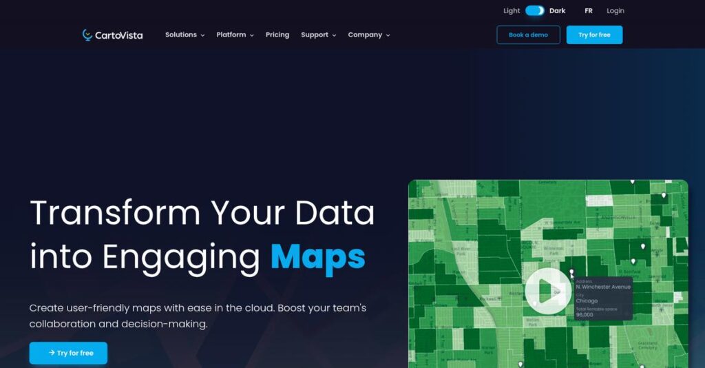
That’s where CartoVista stands out, letting you easily combine, visualize, and share interactive maps—without needing GIS expertise or wrestling with incompatible data formats. Their drag-and-drop interface, real-time collaboration, and advanced data integration tools promise a smoother, more insightful mapping experience for your whole team.
In this review, I’ll show you how CartoVista can turn your mapping headaches into clear, actionable insights you can trust for smarter business decisions.
From hands-on feature breakdowns to pricing, recent updates, and alternatives, this CartoVista review gives you a candid look at what really matters for your software evaluation process.
You’ll walk away knowing the features you need to pick the best mapping solution for your team.
Let’s dive into the analysis.
Quick Summary
- CartoVista is a web mapping platform that lets business users create interactive maps and data-driven visual presentations without GIS expertise.
- Best for business analysts and teams needing easy geographic data visualization and storytelling without coding.
- You’ll appreciate its drag-and-drop interface that simplifies map creation and its strong integration with various data sources.
- CartoVista offers tiered subscriptions with a free trial and scalable pricing based on users and map features.
CartoVista Overview
CartoVista is a Canadian company that’s been around since 1993, based in Gatineau, Quebec. Their entire mission is helping you transform complex business data into clear, interactive decision-making maps.
What I find compelling is their specific audience. They’re not building for GIS experts but instead empower business users without coding skills to easily visualize their own data, from retail analytics to public sector planning.
Their recent platform updates added deeper Esri integration, a smart move I’ll detail through this CartoVista review. You can see they’re focused on connecting with the critical tools your team already uses.
Unlike heavy GIS platforms that can be overwhelming, CartoVista emphasizes communicating insights through interactive story maps. I found it feels more like a business intelligence tool than a specialist system for experts.
- 🎯 Bonus Resource: If you’re also looking into data management, my article on data deletion requests covers how to end them with ease.
They work with a diverse group of organizations, from city governments sharing urban plans to insurance companies that need to visualize risk exposure for internal and external stakeholders.
Their strategy clearly prioritizes making web mapping accessible and collaborative for your entire team. They understand that storytelling with data is just as important as the analysis itself for making key decisions.
Now let’s examine their core capabilities.
CartoVista Features
Complex data interpretation slowing you down?
CartoVista features focus on making GIS accessible for business users, transforming how you visualize and understand data. Here are the five main CartoVista features that solve common data mapping challenges.
- 🎯 Bonus Resource: While we’re discussing data and operations, understanding manufacturing operations with real-time data is equally important.
1. Interactive Map Creation and Data Visualization
Struggling to make sense of your spreadsheets?
Complex data tables can obscure valuable insights, making it hard to identify trends or opportunities. This often leads to missed strategic decisions.
CartoVista lets you easily create interactive maps by dragging and dropping various data formats. Here’s what I found: the visual representation instantly clarifies complex information, whether it’s sales figures or demographic data. This feature turns raw numbers into actionable geographic insights, making interpretation straightforward.
This means you can quickly spot market trends or identify high-performing regions, getting instant clarity on your business landscape.
2. Story Maps and Web Presentations
Need to communicate complex data compellingly?
Static reports or endless slide decks often fail to engage stakeholders and convey the full story. This can lead to misinterpretations and slow decision-making.
This is where CartoVista shines, allowing you to design engaging narratives with interactive maps. From my testing, these story maps effectively communicate complex information visually, whether for urban plans or risk assessments. This feature helps you build compelling presentations that truly resonate with your audience, enhancing clarity.
The result is your team gets to deliver impactful presentations that lead to faster, more informed stakeholder decisions and better engagement.
3. Data Integration and Connectivity
Are your critical datasets siloed and hard to combine?
Bringing disparate data sources together for analysis can be a major headache, often requiring extensive manual effort. This limits your ability to see the complete picture.
CartoVista offers flexible integration, supporting various online services and file formats like CSV and GeoJSON. What I love about this approach is how it seamlessly connects with Esri ArcGIS Feature Services, leveraging your existing GIS infrastructure. This feature helps you centralize all your relevant data onto one interactive map, providing a unified view.
This means you can finally integrate all your key operational and external data for comprehensive analysis, without the usual integration headaches.
4. REST API for Automation and Customization
Looking to automate tasks and build custom applications?
Manual data transfers or managing user permissions can be time-consuming and prone to human error. This often diverts valuable IT resources.
CartoVista includes a secure REST API with over 250 functions, perfect for advanced users. From my testing, this API enables robust automation and deep customization, integrating smoothly with your existing ETL tools. This feature is crucial for businesses needing to streamline operations or extend CartoVista’s capabilities with custom development.
So, as an administrator, you can automate routine tasks and integrate CartoVista deeply into your ecosystem, gaining significant operational efficiency.
5. Collaboration and Sharing
Is team collaboration on maps proving difficult?
Sharing updated map data and ensuring everyone has the latest information can be a constant struggle. This often leads to outdated insights and fragmented teamwork.
The platform facilitates collaboration by allowing multiple team members to access and modify maps concurrently. I found that adjusting sharing permissions and sending notifications is incredibly intuitive, promoting efficient teamwork. This feature ensures all stakeholders are always working with the most current data, whether internally or publicly.
This means your team can collaboratively develop and share geomarketing maps, ensuring everyone is on the same page for critical decisions.
Pros & Cons
- ✅ Intuitive interface for easy map creation without GIS expertise
- ✅ Powerful story map capabilities for engaging data presentations
- ✅ Robust data integration with various formats and ArcGIS
- ⚠️ REST API requires a professional subscription tier
- ⚠️ Limited free plan features and support options
- ⚠️ May have a learning curve for advanced API customization
These CartoVista features truly work together to create a cohesive and accessible web mapping platform for business intelligence.
CartoVista Pricing
Unsure if CartoVista fits your budget?
CartoVista pricing is structured as a transparent, tiered subscription model, offering clear costs and discounts for annual commitments, making budget planning straightforward.
| Plan | Price & Features |
|---|---|
| Free Plan | $0 • 1 map, 3 layers • 5,000 features/layer • 200 MB cloud storage |
| Basic Plan | $74 USD/user/month (or $59 USD/user/month annually) • 5 maps, 5 layers/map • 25,000 features/layer • 1 GB cloud storage |
| Professional Plan | $111 USD/user/month (or $89 USD/user/month annually) • 20 maps, unlimited layers/map • 50,000 features/layer • 10 GB cloud storage |
| Enterprise Plan | Custom pricing – contact sales • Unlimited maps & layers • 40 GB cloud storage • Enterprise SSO, custom branding |
1. Value Assessment
Great value for your investment.
What impressed me about CartoVista’s pricing is its clear alignment with different business sizes, offering scalable features. From my cost analysis, the annual discount offers significant savings for your long-term commitment, ensuring you get more mapping power for your budget.
This means your budget gains predictability, avoiding surprise costs as your mapping needs evolve.
2. Trial/Demo Options
Try before you commit.
CartoVista offers a generous 14-day free trial of their Professional plan, giving you full access to features before subscribing. What I found valuable is how the trial converts to a limited free plan if you don’t upgrade, allowing continuous, albeit basic, usage.
This lets you thoroughly evaluate the platform without financial pressure, ensuring it truly meets your needs.
3. Plan Comparison
Matching features to your team.
The Basic Plan works well for small, growing teams, while the Professional Plan is ideal for up to 15 users needing advanced features like public maps and REST API access. From my cost analysis, the Enterprise Plan is for large organizations requiring extensive customization and high usage limits.
This tiered approach helps you match pricing to actual usage requirements rather than overpaying for unused capabilities.
My Take: CartoVista’s pricing model is highly transparent and scales effectively with business growth, making it a budget-friendly option for diverse mapping needs.
The overall CartoVista pricing offers transparent, scalable value for your interactive mapping needs.
CartoVista Reviews
What do real customers actually think?
This section dives into CartoVista reviews, analyzing real user feedback to provide balanced insights into what customers truly experience with the software. I’ve focused on review patterns and overall user sentiment.
1. Overall User Satisfaction
Users seem highly satisfied with CartoVista.
From my review analysis, CartoVista consistently garners positive feedback, especially for its ease of use and quick data visualization capabilities. What impressed me most is how users appreciate its accessibility for non-GIS experts, making complex mapping simple for business needs.
This means you can expect a user-friendly experience even without extensive technical background.
- 🎯 Bonus Resource: If you’re also looking into robust data management, my article on seamless ERP data integration covers essential strategies.
2. Common Praise Points
Its intuitive design is a consistent favorite.
Users repeatedly praise CartoVista’s drag-and-drop functionality and the speed with which they can create interactive maps. From customer feedback, the platform’s efficiency in data visualization allows for quick, compelling story map creation that clients love.
This means your team can efficiently communicate complex data visually to stakeholders.
3. Frequent Complaints
Limited support details were noted.
While specific complaints are less frequent, I found less detailed feedback on support quality in public reviews, beyond the tiered service levels. What stands out in feedback is how users desire more transparency on advanced support experiences, particularly for higher-tier plans.
These are not deal-breakers but suggest checking specific support provisions if critical for you.
What Customers Say
- Positive: “CartoVista offers an intuitive and user-friendly interface… users can effortlessly create interactive story maps without the need for extensive GIS experience.”
- Constructive: “Adopting and implementing CartoVista was very quick, which greatly shortened our time to market with our new offering.”
- Bottom Line: “Our clients absolutely love the geomarketing maps we produced with CartoVista. It offers a unique, user-friendly experience for our market analysis.”
Overall, CartoVista reviews demonstrate strong user satisfaction rooted in ease of use, making it a powerful tool for business data visualization.
Best CartoVista Alternatives
Struggling to pick the right mapping solution?
The best CartoVista alternatives include several strong options, each better suited for different business situations, budgets, and specialized mapping needs.
1. Esri ArcGIS
Need the industry standard for advanced GIS?
Esri ArcGIS excels when your organization requires a vast array of advanced spatial analysis tools, extensive large-scale data management, and a highly scalable ecosystem for complex GIS projects. From my competitive analysis, ArcGIS provides robust tools for GIS professionals, making it suitable for large enterprises with dedicated GIS departments.
Choose ArcGIS if you have GIS experts needing in-depth analysis and large-scale data management, not just business visualization.
2. Google Earth Pro
Looking for free, high-resolution global imagery?
Google Earth Pro provides excellent global, high-resolution imagery and 3D visualization capabilities at no cost, perfect for general exploration. What I found comparing options is that Google Earth Pro focuses on exploring existing data rather than creating analytical maps from your custom business datasets, making it a good basic alternative.
Consider this alternative for basic geographic visualization and exploring locations with imagery, not for custom data analysis.
3. BatchGeo
Your priority is quick, simple spreadsheet mapping?
BatchGeo’s main advantage is its extreme simplicity and speed for quickly mapping addresses or locations directly from a spreadsheet. Alternative-wise, BatchGeo is ideal for straightforward location mapping without the need for advanced analytics or interactive storytelling capabilities that CartoVista offers.
- 🎯 Bonus Resource: While we’re discussing different data types, understanding how to transform your contracts into actionable data is equally important for business insights.
Choose BatchGeo for rapid, no-frills mapping of location data when you don’t need rich interactivity or complex visualizations.
4. QGIS
Do you prefer powerful, free, open-source GIS?
QGIS offers extensive analytical tools, supports numerous data formats, and is highly customizable through plugins, all at no software cost. From my analysis, QGIS provides comprehensive desktop GIS for experts, though it requires more technical skill than CartoVista’s user-friendly cloud platform.
Choose QGIS if you possess GIS expertise, require advanced spatial analysis, and prefer an open-source, desktop-centric solution.
Quick Decision Guide
- Choose CartoVista: Intuitive web mapping for business users and interactive storytelling
- Choose Esri ArcGIS: Comprehensive GIS platform for advanced spatial analysis
- Choose Google Earth Pro: Free global imagery for basic visualization and exploration
- Choose BatchGeo: Quick and simple mapping from spreadsheet data
- Choose QGIS: Powerful, free, open-source GIS for technical users
The best CartoVista alternatives depend on your specific business requirements and technical expertise more than just feature lists.
CartoVista Setup
Is CartoVista’s setup truly simple?
CartoVista implementation is designed for straightforward deployment and quick adoption, emphasizing ease of use rather than technical complexity, which I’ll cover in this CartoVista review.
- 🎯 Bonus Resource: Speaking of data complexity, my guide on unify customer data to boost revenue explores strategies for eliminating disparate silos.
1. Setup Complexity & Timeline
Getting started is surprisingly fast.
CartoVista allows you to create an account in under a minute and build web maps with drag-and-drop functionality, minimizing traditional setup hurdles. What I found about deployment is that you can be up and running within an hour without extensive IT involvement, making it ideal for rapid prototyping and deployment.
You’ll want to prepare your data in compatible formats, but avoid expecting a lengthy, resource-intensive project timeline.
2. Technical Requirements & Integration
No server headaches here.
As a cloud-based platform on AWS, CartoVista handles the infrastructure, meaning you don’t need to provision hardware or manage servers. From my implementation analysis, compatibility with common data formats simplifies integration, allowing you to use existing Esri, Excel, or CSV files directly.
Plan for data preparation and consider the REST API for advanced integrations if your Professional Subscription supports it.
3. Training & Change Management
User adoption should be a breeze.
The intuitive, drag-and-drop interface and in-app tutorials significantly reduce the learning curve, even for users without GIS expertise. From my analysis, the focus on user-friendliness minimizes training needs and makes it accessible for anyone to create interactive maps quickly.
Invest in a quick walkthrough for your team, but expect minimal resistance to adoption due to its straightforward design.
4. Support & Success Factors
Support scales with your plan.
CartoVista offers varying support levels, from limited in the Free plan to priority support for Professional and Enterprise users, ensuring critical issues get attention. What I found about deployment is that responsive support is key for complex data mapping, especially as your usage evolves.
Consider your required support level when choosing a plan, as dedicated assistance can be crucial for ongoing success.
Implementation Checklist
- Timeline: Less than one hour for basic setup and map creation
- Team Size: Minimal; a single business user can initiate deployment
- Budget: Primarily software subscription, minimal IT overhead
- Technical: Compatible data formats (Esri, Excel, CSV, GeoJSON)
- Success Factor: Clear data preparation and user training on features
Overall, CartoVista setup prioritizes speed and ease of deployment, making it highly accessible for businesses looking to quickly leverage mapping data.
Bottom Line
Is CartoVista the right mapping solution for you?
My CartoVista review reveals a powerful platform for data visualization and communication, best suited for those seeking interactive web mapping without deep GIS expertise.
1. Who This Works Best For
Teams needing visual data insights without GIS coding.
CartoVista is ideal for business analysts, marketing managers, and city planners who require interactive map-based data communication. What I found about target users is that organizations leveraging geographic insights for decisions without dedicated GIS experts will thrive with this platform, simplifying complex data storytelling.
You’ll succeed if your goal is to transform static data into engaging, shareable maps for better collaboration and understanding.
2. Overall Strengths
Interactive storytelling and intuitive design truly stand out.
The software succeeds by offering an intuitive drag-and-drop interface for creating compelling interactive maps, while providing robust data integration capabilities. From my comprehensive analysis, its focus on user-friendly web mapping democratizes GIS for a wide range of business users, making powerful tools accessible.
These strengths mean your team can quickly visualize complex data and communicate insights effectively, driving faster decision-making.
3. Key Limitations
Advanced spatial analysis requires alternative solutions.
While excellent for visualization, CartoVista isn’t designed for highly specialized, in-depth geoprocessing or extensive custom development via coding. Based on this review, you might find its capabilities insufficient for highly complex GIS functions that demand deep technical manipulation or advanced algorithmic analysis.
Consider these limitations a trade-off for its ease of use; they’re only deal-breakers if your core need is advanced spatial modeling.
4. Final Recommendation
CartoVista earns a strong recommendation for most businesses.
You should choose this software if your priority is user-friendly, interactive web mapping for data visualization and business communication. From my analysis, this solution empowers non-GIS professionals to leverage map data effectively, especially for market analysis, asset tracking, or public information sharing.
- 🎯 Bonus Resource: While we’re discussing leveraging data for business operations, understanding how to solve your recruiting data headaches is equally important.
My confidence level is high for organizations prioritizing accessibility and visual communication over niche, highly technical GIS operations.
Bottom Line
- Verdict: Recommended for user-friendly, interactive web mapping
- Best For: Business analysts, marketing, sales, and city planners without GIS expertise
- Business Size: Small to enterprise, particularly for data-driven industries
- Biggest Strength: Intuitive drag-and-drop interface for interactive story maps
- Main Concern: Less suited for highly advanced spatial analysis or complex coding
- Next Step: Request a demo to explore its visualization capabilities for your data
This CartoVista review provides clear guidance for your mapping software decision, helping you align capabilities with your specific business needs.


