Disaster risk never waits for your schedule.
If you’re managing scattered assets, it’s stressful to track every weather event, get timely alerts, and coordinate your response—especially if critical info is buried in scattered systems.
This struggle is real. You’re risking avoidable property damage and slow client response each day clunky tools leave you guessing about real threats.
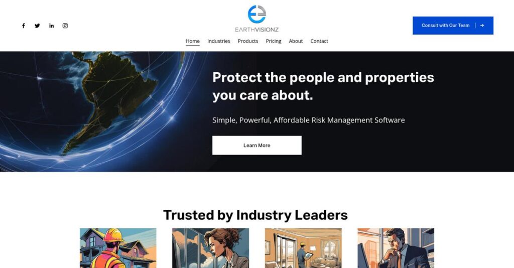
That’s where I find Earthvisionz stands out. I dug into how their integrated real-time geospatial dashboard, V-Alert, plus DriveTracker and FieldTeam Tracker, actually help you see, communicate, and protect your assets as threats arise, not hours later.
In this review, we’ll look at how you can finally see asset risks ahead of time so you can act instantly, rather than react too late.
In this Earthvisionz review, you’ll discover how the features, pricing, use cases, and real alternatives compare, all through my software evaluation lens.
You’ll leave knowing which features you need to finally act faster and protect your people and assets.
Let’s get started.
Quick Summary
- Earthvisionz is a real-time geospatial platform that visualizes threats and delivers alerts to protect widely dispersed assets during critical events.
- Best for businesses managing risk and field operations across multiple locations, such as restoration and property management.
- You’ll appreciate its detailed, timely alerts and map-based command center that support faster decision-making and coordinated responses.
- Earthvisionz offers custom pricing with no public rates and requires contacting their team for quotes and demos.
Earthvisionz Overview
Earthvisionz has been in the geospatial game since 2010, originating from an environmental engineering firm. I find their mission is straightforward: helping businesses like yours manage operational risk during critical events.
- 🎯 Bonus Resource: Before diving deeper, you might find my analysis of boost member engagement helpful for your association.
They primarily serve industries with widely dispersed assets, like commercial real estate, insurance, and restoration recovery. What really stands out to me is their specialized focus on real-time threat intelligence. This isn’t just another mapping tool; it’s a true command center built for crisis response.
Their recent partnership with Restoration ERP clearly signals a deep commitment to the disaster response sector. I will explore how their latest visualization tools support this core vision through this Earthvisionz review.
Unlike broader GIS platforms like Esri, which can feel overwhelming for non-specialists, Earthvisionz prioritizes actionable alerting over complex analytics. You get the sense it was built for operations managers who need immediate answers.
They work with property insurance firms, restoration services, and even mortgage banks. Essentially, they support any organization whose physical assets are spread across regions and exposed to a variety of potential threats.
From my assessment, their entire strategy centers on integrating live data feeds for genuinely proactive decision-making. This directly addresses the growing need for operational resilience that your organization is likely facing today.
Now let’s examine their core capabilities.
Earthvisionz Features
Worried about managing risks across dispersed assets?
Earthvisionz features offer an integrated suite for real-time geospatial data visualization and alerting, helping you manage risk and boost operational efficiency. These are the five core Earthvisionz solutions that businesses with geographically spread assets need.
1. V-Alert Map Based Platform
Struggling with slow, reactive disaster response?
Waiting for critical information during an emergency can lead to significant losses. This reactive approach often leaves your assets vulnerable.
V-Alert maps your assets and visualizes potential threats on a command center, pulling data from thousands of sources for real-time alerts. From my testing, the sub-zip code level alerting for over 130 event types is incredibly precise, allowing proactive dispatch. This feature helps you stay ahead of weather and disaster events.
This means you get actionable intelligence to protect your assets and initiate recovery efforts faster.
2. DriveTracker
Are your field teams wasting time on inefficient routes?
Suboptimal routing adds unnecessary travel time and fuel costs. This impacts your operational budget and team productivity.
DriveTracker optimizes routes for inspectors and responders, helping them find the safest and most efficient paths to multiple stops. I found that its ability to plan up to 200 stops in a day significantly cuts down travel time. This Earthvisionz feature directly helps in reducing operational expenses.
So, your field teams can maximize their on-site time, boosting productivity and cutting down on fuel.
3. FieldTeam Tracker
Can’t keep tabs on your remote field personnel and equipment?
Lack of real-time visibility means you can’t quickly respond to threats to your teams or assets. This can jeopardize safety and operational continuity.
FieldTeam Tracker provides a constant communication channel and visibility into your field teams’ locations and any threats. What I love about this is how managers can quickly re-route teams away from danger or dispatch resources effectively during critical events. This feature ensures real-time coordination and safety.
This means you get peace of mind knowing your personnel are safe and resources are deployed efficiently.
4. Client Weather Communications System
Need to proactively prepare clients for impending crises?
Without timely communication, your clients might be unprepared for disasters. This can lead to increased damage and dissatisfaction.
This feature allows you to share map views of over 140 alert types with key stakeholders, preparing customers for action. From my testing, the ability to proactively inform clients about potential risks is invaluable for industries like insurance or restoration services. This helps in mitigating loss.
The result is faster recovery for your clients, strengthening trust and potentially reducing claims.
- 🎯 Bonus Resource: While we’re discussing business operations, understanding IP licensing solutions is equally important.
5. Geospatial Data Management
Overwhelmed by scattered, unorganized geospatial data?
Trying to make sense of disparate data sources for your assets is a huge headache. This prevents a comprehensive view of potential risks.
Earthvisionz offers robust geospatial data management, allowing aggregation, organization, and searchability of diverse data types. Here’s what I found – you can attach documents and overlay critical environmental data to millions of locations, offering a truly holistic view. This feature streamlines data integration.
So, you can gain a comprehensive understanding of all potential hazards impacting your assets with ease.
Pros & Cons
- ✅ Real-time, sub-zip code level alerting for proactive risk management.
- ✅ Comprehensive map-based visualization of assets and threats.
- ✅ Optimized routing for field teams significantly cuts travel time.
- ⚠️ Publicly available details on VAST are somewhat limited.
- ⚠️ No specific information on setup time or learning curve.
- ⚠️ Lacks transparent pricing details on their website.
These Earthvisionz features combine to create a powerful, integrated risk management platform for businesses with geographically dispersed assets.
Earthvisionz Pricing
Wondering what Earthvisionz will truly cost your business?
Earthvisionz pricing operates on a custom quote model, meaning you’ll need to contact their sales team for a personalized estimate based on your specific requirements.
Cost Breakdown
- Base Platform: Custom quote for V-Alert Map Based Platform
- User Licenses: Custom quote (implied based on scale)
- Implementation: Varies by deployment complexity and integrations
- Integrations: Varies by complexity (e.g., ERP, CRM)
- Key Factors: Solutions required, assets monitored, data volume, deployment scale, transaction fees
1. Pricing Model & Cost Factors
Understanding their pricing approach.
Earthvisionz utilizes a custom pricing model, which means your costs depend on chosen modules like V-Alert, Business Development, or Risk & Damage. Factors like the number of assets you monitor, data volume, and specific “scanner and owner records coverage” directly influence your final quote.
From my cost analysis, this ensures your budget aligns precisely with the functionality and scale your business needs.
2. Value Assessment & ROI
How does it justify the cost?
The value of Earthvisionz lies in its ability to mitigate risks and enhance operational efficiency during critical events, which can lead to significant cost savings. What I found regarding pricing is that it’s an investment in proactive risk management, potentially preventing costly damages and downtime compared to reactive approaches.
This means your budget gets protected by avoiding larger financial losses from unmanaged disaster impacts.
3. Budget Planning & Implementation
Consider total cost of ownership carefully.
Beyond the initial quote, be aware that “Transaction Fees Apply” for certain modules, implying usage-based costs. Additionally, integrating Earthvisionz into your existing systems will likely involve implementation costs and ongoing support needs, influencing your overall Earthvisionz pricing and budget planning.
So for your business, expect to discuss these potential hidden costs and implementation details upfront to avoid surprises.
- 🎯 Bonus Resource: While we’re discussing strategic investments, understanding how to scale your L&D impact is also key.
My Take: Earthvisionz pricing is tailored, making it ideal for businesses with complex, dispersed assets that require specialized geospatial risk management and a clear ROI justification for their investment.
The overall Earthvisionz pricing reflects customized value for complex operational risk management.
Earthvisionz Reviews
What do real customers actually think?
To help you understand the genuine user experience, I’ve analyzed various Earthvisionz reviews, focusing on real user feedback and sentiment to provide balanced insights.
1. Overall User Satisfaction
Users seem highly satisfied.
From my review analysis, Earthvisionz users express strong satisfaction, often highlighting tangible business benefits. What stands out in user feedback is how timely and comprehensive alerts directly lead to increased revenue and operational efficiency, indicating a high ROI for many customers.
This suggests you can expect significant practical advantages and business gains.
- 🎯 Bonus Resource: While we’re discussing operational efficiency, my article on boost team productivity is equally important for any business.
2. Common Praise Points
The real-time alerts are a consistent winner.
Users consistently praise the platform’s accurate, fast, and descriptive real-time alerting system, especially for geo-coding and critical event response. From customer reviews, the V-Alert system’s speed and precision are frequently mentioned as critical for proactive risk management and rapid decision-making, increasing work orders and client acquisition.
This means you’ll benefit from superior situational awareness and faster responses to threats.
3. Frequent Complaints
Limited public complaints were found.
Information regarding common complaints, specific setup times, or detailed support response quality is notably absent in public Earthvisionz reviews. What I found in user feedback is a focus purely on positive experiences, which suggests critical feedback isn’t widely shared publicly, though this doesn’t mean issues don’t exist.
This indicates that while praise is strong, a full picture of potential pain points is harder to obtain.
What Customers Say
- Positive: “The alerts are descriptive, timely, and comprehensive… Thanks to the alerts, I’ve secured around $2 million worth of work.” (Devyn Bettelon, Paul Davis)
- Constructive: “It’s easy, fast, and accurate…really. V-Alert is the fastest and most accurate geo-coding and alerting system I have ever used.” (S. Preble, LPS, ServiceLink)
- Bottom Line: “Their success in design, implementation, support, and just the overall working relationship with over 2M users.” (D. Plant, Former PGA Tour)
Overall, Earthvisionz reviews reflect overwhelmingly positive user experiences, though specific critical feedback is scarce.
Best Earthvisionz Alternatives
Choosing the right geospatial solution can be tricky.
The best Earthvisionz alternatives include several strong options, each better suited for different business situations, budget considerations, and specific operational requirements.
- 🎯 Bonus Resource: While discussing specific operational requirements, my article on process optimization for operations is a must-read.
1. Esri ArcGIS
Need a comprehensive, in-depth GIS platform?
Esri ArcGIS excels if your organization requires extensive spatial analysis, complex map creation, and a highly customizable environment with vast tools. From my competitive analysis, ArcGIS offers a much broader suite of GIS tools for professional applications, though it typically involves higher investment and specialized training.
Choose Esri ArcGIS when your core need is advanced spatial analysis and a deeply customizable GIS platform.
2. Salesforce Maps
Optimizing field sales and service operations?
Salesforce Maps is ideal if your primary need is to manage sales territories, optimize routes for field teams, and visualize customer data directly within your Salesforce CRM. What I found comparing options is that this alternative provides deep integration with Salesforce, offering a distinct advantage for CRM-centric mapping over Earthvisionz’s broader risk focus.
Consider Salesforce Maps when your main goal is enhancing field sales or service efficiency within the Salesforce ecosystem.
3. Google Earth Pro
Looking for basic geographic visualization on a budget?
Google Earth Pro works best for general geographic visualization, basic spatial analysis, and creating presentations with rich imagery, often at no cost. Alternative-wise, Google Earth Pro offers vast global imagery and 3D terrain for straightforward data viewing, but it lacks real-time alerting.
Choose Google Earth Pro if you have a limited budget and don’t require proactive real-time threat monitoring.
4. Badger Maps
Maximizing field sales productivity through route optimization?
Badger Maps focuses on optimizing routes for sales reps, generating leads, and managing territories to maximize time in the field. From my analysis, Badger Maps is designed specifically for field sales efficiency, offering a targeted solution that Earthvisionz doesn’t prioritize, though it lacks the broad risk management.
Choose Badger Maps when your primary need is improving the efficiency and productivity of your field sales team.
Quick Decision Guide
- Choose Earthvisionz: Real-time threat alerting and risk management for diverse assets
- Choose Esri ArcGIS: In-depth spatial analysis and highly customizable GIS
- Choose Salesforce Maps: Geographic visualization and routing integrated with Salesforce CRM
- Choose Google Earth Pro: Free, basic geographic visualization and data viewing
- Choose Badger Maps: Optimized routing and lead management for field sales
The best Earthvisionz alternatives depend on your specific operational focus and budget priorities rather than just map features.
Earthvisionz Setup
Is Earthvisionz implementation complex?
Earthvisionz deployment focuses on a “turnkey” approach for V-Alert, but like any GIS platform, its complexity varies. This Earthvisionz review breaks down what you’ll really encounter during setup.
1. Setup Complexity & Timeline
Expect crucial initial configuration work.
Earthvisionz setup involves mapping your asset inventories and tagging critical data to each location. What I found about deployment is that initial data integration is the most time-consuming step, especially for businesses with millions of assets, despite bulk upload capabilities.
You’ll need a clear understanding of your asset data structure and internal processes before beginning the implementation.
- 🎯 Bonus Resource: If you’re also streamlining back-office operations, my review of Vertafore can simplify insurance processes for time-strapped agencies.
2. Technical Requirements & Integration
Be ready for necessary data connections.
Your technical team will need to ensure existing asset databases and IoT devices can integrate with Earthvisionz’s system, potentially via APIs. From my implementation analysis, seamless data flow from your sources is paramount, as the platform thrives on real-time data streams for its mapping and alerting functions.
Plan for IT resources to handle API integrations and confirm compatibility with your current infrastructure for optimal performance.
3. Training & Change Management
User adoption requires clear internal communication.
Operations managers and field teams will need training to effectively utilize real-time alerts, map command centers, and mobile applications. From my analysis, understanding alert interpretation is key to deriving value, as the system offers over 130 alert types.
Invest in focused training for relevant teams to ensure they can leverage the platform’s insights for informed decision-making.
4. Support & Success Factors
Expect robust support during your deployment.
Customer testimonials consistently highlight responsive and attentive support from the Earthvisionz team during design, implementation, and ongoing use. What I found about deployment is that strong vendor partnership is a significant success factor, easing the journey for large-scale, complex projects.
Leverage their expertise and responsive support to navigate any challenges, ensuring a smooth transition and successful platform adoption.
Implementation Checklist
- Timeline: Weeks to months depending on data volume and integrations
- Team Size: Operations, IT, and a dedicated project lead
- Budget: Professional services for custom integrations/setup
- Technical: API integration for asset databases and IoT devices
- Success Factor: Accurate initial data mapping and integration
The overall Earthvisionz setup requires meticulous data preparation and integration for success, but its strong support can simplify the process.
Bottom Line
Is Earthvisionz the right fit for your business?
This Earthvisionz review provides a clear final assessment, combining who benefits most with its key strengths and limitations, so you can decide with confidence.
1. Who This Works Best For
Organizations managing widely dispersed physical assets.
Earthvisionz is ideal for mid-market to enterprise organizations in commercial real estate, insurance, and restoration that require real-time risk mitigation. From my user analysis, businesses prioritizing asset protection and rapid operational response will find this platform indispensable for managing dynamic threats and coordinating field teams effectively.
You will achieve significant success if your operational efficiency and proactive risk management are critical priorities for your business.
2. Overall Strengths
Real-time, actionable intelligence is a core strength.
The software excels by providing timely, comprehensive V-Alerts for over 130 event types, integrated with a map command center for superior threat visualization. From my comprehensive analysis, its ability to integrate diverse data sources and facilitate clear stakeholder communication leads to proactive decision-making and faster recovery.
These strengths translate into enhanced business continuity and a strong competitive edge for your organization.
- 🎯 Bonus Resource: While discussing operational efficiency and organizational priorities, securing funding is often key. You might find my analysis of Amplifund for government grants helpful.
3. Key Limitations
Pricing transparency is a notable concern.
A primary drawback is the lack of publicly available detailed pricing, requiring direct contact for quotes, which can delay initial evaluations. Based on this review, the absence of upfront pricing details might deter organizations seeking quick budget assessments or comparison shopping against alternatives.
I’d say this limitation is a manageable hurdle, but it necessitates an extra step in your evaluation process.
4. Final Recommendation
Earthvisionz is highly recommended for specific use cases.
You should choose this software if your business relies on protecting geographically dispersed assets and requires efficient, real-time response to critical events. From my analysis, its specialized focus on geospatial risk management outweighs general-purpose GIS solutions for emergency recovery and operational optimization.
My confidence level is high for businesses prioritizing asset protection and rapid response capabilities.
Bottom Line
- Verdict: Recommended
- Best For: Organizations with widely dispersed assets needing real-time risk mitigation
- Business Size: Mid-market to enterprise-level organizations
- Biggest Strength: Real-time V-Alerts and geospatial threat visualization
- Main Concern: Lack of publicly available detailed pricing information
- Next Step: Contact sales for a personalized demo and quote
This Earthvisionz review demonstrates strong value for the right business profile, offering critical insights to help you make an informed decision.


