Mapping data shouldn’t be this complicated.
If you’re searching for a GIS tool, you’re probably frustrated by complex software and high price tags that slow down serious mapping or spatial analysis projects.
Here’s the real pain—wasting valuable hours wrestling with clunky interfaces—instead of actually visualizing, editing, or analyzing your spatial data.
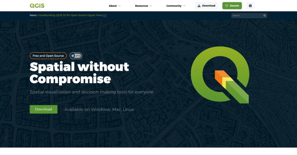
That’s where QGIS stands out. As an open-source GIS platform, it gives you professional-grade data visualization, custom mapping, and analysis tools without the licensing headaches or expensive add-ons. I’ve dug deep into QGIS’s core features, extensibility through plugins, and its powerful compatibility across Windows, Mac, Linux, and even Android.
In this review, I’ll show you how you can fix your spatial workflow bottlenecks and get truly flexible control over your geospatial data using QGIS.
You’ll find a full breakdown of features, pricing structure, my testing insights, and how QGIS compares to alternatives in this QGIS review.
You’ll walk away with the features you need to make a smart decision and avoid those mapping headaches.
Let’s get started.
Quick Summary
- QGIS is a free and open-source GIS software for creating, editing, visualizing, and analyzing geospatial data across platforms.
- Best for organizations seeking a cost-effective, customizable GIS solution with strong community support.
- You’ll appreciate its extensive plugin ecosystem and ability to handle diverse data formats without licensing costs.
- QGIS offers no-cost software use but requires time investment for learning and optional paid training or commercial support.
QGIS Overview
QGIS is a unique, volunteer-driven project under the Open Source Geospatial Foundation. Since its 2002 inception, its core mission has been making professional-grade GIS technology freely accessible to everyone.
They serve a broad spectrum of users, from individual consultants to entire public agencies and non-profits. What I find compelling is their focus on empowering budget-conscious teams, offering serious analytical power without a restrictive enterprise price tag.
- 🎯 Bonus Resource: If you’re also looking into other types of powerful analytical software, my article on best business valuation software covers essential tools for financial analysis.
Because it’s a community effort, development feels organic, with steady improvements from a global volunteer base. I’ll analyze the impact of its most recent software releases through this QGIS review.
Unlike proprietary systems like Esri’s ArcGIS Pro that lock you into their ecosystem, QGIS provides powerful geoprocessing tools without licensing fees. This open approach gives your team incredible flexibility and genuine platform freedom.
I see it used by environmental consultants, city planners, and university researchers worldwide. It’s a reliable workhorse for any organization that needs powerful mapping capabilities, especially those on a tight budget.
The project’s strategic direction is all about democratizing access to complex GIS technology. You can really feel this in the community’s relentless focus on performance, usability, and a massive plugin ecosystem that lets you build your ideal toolset.
Now let’s examine its core capabilities.
QGIS Features
Dealing with outdated mapping tools?
QGIS features offer a robust, open-source solution for all your geospatial needs. Here are the five main QGIS features that provide professional GIS capabilities without the hefty price tag.
1. Data Visualization and Cartography
Struggling to make maps that tell a clear story?
Generic map styling often fails to convey critical information effectively, leading to confusion. This can limit the impact of your geographic data.
QGIS excels at creating visually stunning maps with extensive customization options for styling. From my testing, the precise control over symbology and 3D rendering truly shines, allowing me to design maps for both digital and print applications with incredible detail. This feature lets you combine diverse data types seamlessly.
This means you can produce high-quality, impactful maps that communicate your insights clearly and professionally to stakeholders.
- 🎯 Bonus Resource: While we’re discussing the cost-effectiveness of open-source solutions, understanding spend analysis software is equally important for optimizing your budget.
2. Data Management and Editing
Is your spatial data scattered and hard to manage?
Inefficient data handling can lead to inconsistencies and wasted time, making accurate analysis nearly impossible. This often frustrates your team.
QGIS provides robust tools for managing and editing diverse GIS data, including seamless GPS integration for fieldwork. What I love about this approach is how vertex handling mimics CAD for precise digitization, streamlining data capture and organization. This feature supports easy import of various formats.
So you can efficiently organize, edit, and retrieve spatial data, ensuring your datasets are always accurate and up-to-date for projects.
3. Spatial Analysis and Geoprocessing
Need to perform complex geographical analysis with ease?
Limited analytical capabilities can prevent you from extracting meaningful insights from your spatial data. This often leaves you guessing.
QGIS offers a comprehensive suite of spatial analysis tools for complex queries, including buffer, overlay, and network analysis. Here’s where QGIS gets it right: it integrates powerful external libraries like GRASS and SAGA, providing advanced geoprocessing power. This feature handles raster DEMs smoothly.
This means you can perform sophisticated analyses to uncover patterns and relationships, helping you make data-driven decisions confidently.
4. Plugin Architecture and Extensibility
Feel limited by out-of-the-box software functionalities?
Being stuck with fixed features means you can’t adapt the software to your unique business needs. This can stifle innovation.
A significant strength of QGIS is its vast ecosystem of community-developed plugins that extend core functionalities. From my testing, the quick access to basemaps via QuickMapServices plugin truly empowers customization, letting you tailor the platform. This feature allows integration with statistical tools like R and Python.
The result is your team gets a highly flexible and adaptable GIS platform that can grow and evolve with your specific project requirements.
5. Cross-Platform Compatibility
Is your team struggling with incompatible software across different operating systems?
Software limitations based on OS can create silos and hinder collaboration, leading to inefficient workflows. This often causes frustration.
QGIS shines with its exceptional cross-platform compatibility, running smoothly on Windows, macOS, Linux, Unix, and Android devices. This is where QGIS shines: it removes barriers for diverse user environments, ensuring everyone can access and use the software. This feature provides flexibility and convenience.
This means you can deploy QGIS across your entire organization, fostering seamless collaboration and ensuring consistent access for all users, regardless of their OS.
Pros & Cons
- ✅ Free and open-source, offering significant cost savings for businesses.
- ✅ Extensive functionality and vast plugin ecosystem for tailored solutions.
- ✅ Supports a wide array of data formats, enhancing interoperability.
- ⚠️ Steeper learning curve for new users due to rich interface.
- ⚠️ Lacks dedicated customer support, relying on community forums.
- ⚠️ Some features require plugin installation, adding a step to workflow.
These QGIS features actually work together to provide a comprehensive and flexible GIS ecosystem, empowering users with powerful mapping and analysis tools without proprietary constraints.
QGIS Pricing
Hidden software costs? Not here!
QGIS pricing is uniquely transparent: it’s free and open-source, eliminating licensing fees entirely. This makes QGIS an incredibly budget-friendly option for all users, from individuals to large organizations.
| Plan | Price & Features |
|---|---|
| Free & Open Source | No Direct Cost • Full access to all features • Data visualization & cartography • Data management & editing • Spatial analysis & geoprocessing • Plugin architecture & extensibility • Cross-platform compatibility |
1. Value Assessment
Unbeatable value proposition.
From my cost analysis, QGIS offers unparalleled value by being completely free. You get professional-grade GIS capabilities without any licensing fees, making it an ideal solution for budget-conscious users. This approach democratizes access to powerful geospatial tools, removing a significant financial barrier for your business.
- 🎯 Bonus Resource: Before diving deeper, you might find my analysis of best student information system helpful.
This means your budget can be redirected to other critical areas, or you can invest in support and training.
2. Trial/Demo Options
Evaluate without commitment.
Since QGIS is entirely free and open-source, there’s no trial period needed. You can download and use the full software immediately, exploring all its features without any time limits. What I found regarding pricing here is you experience the complete product from day one, eliminating any surprises later.
This allows you to fully integrate and test QGIS in your specific environment before investing in any associated services.
3. Plan Comparison
One powerful, free plan.
Unlike commercial software with tiered pricing, QGIS provides all its features in a single, free package. This means you don’t have to choose between features or worry about upgrading. Your access is always to the full software, ensuring you have every tool at your disposal from the start.
This approach helps you match full functionality to your requirements without any financial constraints.
My Take: QGIS’s free and open-source model is its strongest competitive advantage, offering professional GIS capabilities without the burden of licensing costs, ideal for any budget size.
The overall QGIS pricing reflects exceptional value with no direct software cost.
QGIS Reviews
What do real customers actually think?
I’ve delved into numerous QGIS reviews to bring you a balanced analysis of real user feedback, helping you understand what actual customers think about the software.
1. Overall User Satisfaction
Users seem genuinely impressed.
- 🎯 Bonus Resource: If you’re also managing product data, my article on PIM software can streamline rollouts.
From my review analysis, QGIS enjoys high satisfaction, with one site showing a 93% user sentiment from 43 reviews. What I found in user feedback is how users consistently praise its capability, especially considering it’s a free, open-source solution, often noting its powerful flexibility.
This indicates you can expect a highly functional tool without the usual cost.
2. Common Praise Points
Its cost-effectiveness is a standout.
Users consistently love that QGIS is free, making advanced GIS accessible to everyone. Review-wise, its extensive functionality and vast plugin ecosystem are frequently mentioned, allowing users to accomplish almost anything a commercial tool can.
This means you get professional-grade tools and endless customization at no monetary cost.
3. Frequent Complaints
Learning curve and interface complexity.
While powerful, QGIS often presents a steeper learning curve for beginners due to its feature-rich and sometimes dense interface. What stood out in customer feedback is how the sheer number of tools can feel overwhelming, requiring significant time to explore.
These challenges are typically overcome with dedicated learning, not deal-breakers for motivated users.
What Customers Say
- Positive: “First of all QGIS it is a free software in an are that has always been monopolized for big companies like ESRI.” (User Review)
- Constructive: “QGIS offers powerful GIS tools, but its feature-rich interface can feel overwhelming to beginners.” (User Review)
- Bottom Line: “As someone who came from Arc, I’ve yet to find something I couldn’t also accomplish in Q.” (User Review)
The overall QGIS reviews reflect strong appreciation for its power and accessibility, with a common acknowledgment of its initial learning curve.
Best QGIS Alternatives
Which QGIS alternative truly fits your business?
The best QGIS alternatives include several strong options, each better suited for different business situations, technical requirements and budget constraints. Let’s compare.
1. Esri ArcGIS Pro
Need advanced 3D visualization and extensive analysis?
ArcGIS Pro offers more advanced 3D visualization and analysis tools with a highly standardized user interface, perfect for seamless integration within a broader Esri ecosystem. From my competitive analysis, ArcGIS Pro provides robust 3D capabilities that QGIS can’t match, though it requires a significant licensing investment.
Choose this alternative if your budget allows for superior 3D modeling and a guided user experience.
2. MapInfo Pro
Is dedicated support and quick deployment your priority?
MapInfo Pro is often praised for its ease of setup and robust predictive analysis capabilities, backed by strong customer support. What I found comparing options is that MapInfo Pro offers very quick deployment and responsive service, which can be invaluable for businesses needing rapid setup.
Consider this alternative when advanced predictive analysis or hands-on customer service are critical for your business.
- 🎯 Bonus Resource: While discussing different software, securing your data is crucial. My article on best email backup software covers key strategies.
3. Global Mapper
Do you require specialized LiDAR and point cloud processing?
Global Mapper excels in powerful tools for 3D visualization, terrain analysis, and particularly specialized LiDAR and point cloud processing. Alternative-wise, Global Mapper provides cutting-edge terrain analysis capabilities that surpass QGIS in specific niche areas, especially for professional-grade 3D data.
For your specific needs in advanced 3D data handling or responsive customer service, this might be a better choice.
4. SAGA GIS
Are highly specialized geoscientific analyses your core focus?
SAGA GIS offers advanced analytical tools that are particularly beneficial for complex geospatial modeling and specialized geoscientific analyses. From my competitive analysis, SAGA GIS excels in deep geoscientific modeling, making it ideal for researchers or highly technical users.
Choose this alternative when your primary need is complex geospatial modeling and specialized analytical toolsets.
Quick Decision Guide
- Choose QGIS: Cost-effective, customizable open-source GIS for broad use
- Choose Esri ArcGIS Pro: Advanced 3D, standardized UI, enterprise ecosystem
- Choose MapInfo Pro: Quick deployment, predictive analysis, dedicated support
- Choose Global Mapper: Specialized LiDAR/point cloud, advanced 3D terrain
- Choose SAGA GIS: Deep geoscientific modeling, complex geospatial analyses
Ultimately, the best QGIS alternatives decision hinges on your specific project needs and budget flexibility, not just feature lists.
QGIS Setup
Concerned about complicated software setup and training?
This QGIS review section analyzes its implementation process, helping you set realistic expectations for deployment and adoption in your business.
1. Setup Complexity & Timeline
This isn’t a simple plug-and-play deployment.
QGIS installation is straightforward for experienced users, but beginners may find the initial download and compatibility checks tricky. From my implementation analysis, getting started requires some technical comfort, as it’s a desktop installation unlike browser-based alternatives, so plan accordingly.
You’ll need to budget time for initial setup and potential troubleshooting, especially if your team is new to open-source software.
- 🎯 Bonus Resource: While we’re discussing potential troubleshooting, understanding data replication software is equally important for data security.
2. Technical Requirements & Integration
Expect minimal infrastructure changes.
QGIS runs across Windows, macOS, and Linux, offering significant flexibility with existing hardware. What I found about deployment is that it integrates extensively with other open-source tools like PostGIS databases and Python libraries, leveraging its plugin architecture for broad compatibility.
Plan for standard workstation requirements and capitalize on its strong database connectivity and open-source ecosystem for broader integrations.
3. Training & Change Management
User adoption requires some focused effort.
QGIS’s feature-rich interface can overwhelm new users, requiring time to explore numerous tools and menus. From my analysis, the learning curve is steeper for beginners, often necessitating reliance on community forums or external tutorials, as built-in onboarding is limited.
Invest in formal training or empower staff to utilize the extensive community resources to ensure efficient proficiency gains.
4. Support & Success Factors
Community support is your primary resource.
As an open-source project, QGIS relies on its thriving community for support through forums and mailing lists, differing from traditional vendor support. From my analysis, the community is highly responsive and helpful, but organizations needing guaranteed, structured assistance may want to consider commercial contractors.
Plan to leverage the active user community for troubleshooting and knowledge sharing, or allocate budget for professional third-party support if needed.
Implementation Checklist
- Timeline: Weeks to months depending on user proficiency and training
- Team Size: Individual users or dedicated GIS specialists for complex projects
- Budget: Primarily staff time for learning; optional for paid training/contractors
- Technical: Standard workstation, OS compatibility, potential PostGIS integration
- Success Factor: User willingness to self-learn and utilize community resources
Overall, the QGIS setup requires users to be proactive in learning and leveraging community resources, but its open-source nature offers tremendous value once implemented.
Bottom Line
Is QGIS the right GIS solution for you?
This QGIS review will synthesize my analysis into a clear recommendation, helping you understand who should use this powerful software and why.
1. Who This Works Best For
Professionals seeking powerful, cost-effective spatial analysis.
QGIS is ideal for GIS managers, analysts, urban planners, and environmental consultants, particularly within small to medium-sized businesses and public administrations prioritizing cost-effectiveness and customization. From my user analysis, organizations requiring cross-platform compatibility and open-source integration will find it invaluable.
You’ll succeed if your team is willing to invest time in learning and leveraging its active community for support and extended functionality.
2. Overall Strengths
Unparalleled cost-effectiveness with professional-grade features.
The software succeeds by offering a comprehensive suite of GIS tools for data visualization, management, and spatial analysis, all at zero licensing cost. From my comprehensive analysis, its extensive plugin ecosystem dramatically expands core capabilities, allowing for tailored workflows that rivals commercial solutions.
These strengths translate into significant ROI for your business, enabling advanced geospatial work without the prohibitive expenses of proprietary software.
3. Key Limitations
Steeper learning curve without dedicated customer support.
While powerful, new users may find the feature-rich interface overwhelming, requiring significant self-directed learning through community resources. Based on this QGIS review, the lack of direct customer support can challenge troubleshooting for those accustomed to commercial software’s structured assistance channels.
I find these limitations are a fair trade-off for the software’s immense power and cost savings, provided your team embraces self-sufficiency and community engagement.
4. Final Recommendation
QGIS receives my strong recommendation.
You should choose this software if your business needs robust GIS capabilities, values open-source flexibility, and prioritizes budget efficiency. From my analysis, your success hinges on embracing community support and a willingness to explore its vast customization options through plugins.
My confidence level is high for teams prioritizing powerful, adaptable, and free geospatial solutions over out-of-the-box simplicity.
- 🎯 Bonus Resource: While we’re discussing business needs, understanding EHS software solutions is equally important for compliance.
Bottom Line
- Verdict: Recommended
- Best For: GIS professionals and organizations prioritizing cost-effective spatial analysis
- Business Size: Small to large businesses, public administrations, and research bodies
- Biggest Strength: Comprehensive features, extensive plugins, and zero licensing cost
- Main Concern: Steeper learning curve and reliance on community for support
- Next Step: Download and explore the software with community tutorials
This QGIS review shows strong value for the right business profile, offering professional-grade GIS capabilities that can meet diverse and complex geospatial needs.


