Messy infrastructure data slowing you down again?
If you’re tasked with keeping public assets running smoothly, it’s easy to feel buried by paper trails, duplicated efforts, and scattered work requests that never get closed.
That’s because too often, your team wastes hours on manual tracking, and you’re left with incomplete records and never-ending backlogs.
Cartegraph is designed to fix all that. I’ve dug deep into how their mobile-first, GIS-integrated platform goes beyond checklists—connecting assets, work orders, resource tracking, and citizen requests in one intuitive system that actually saves you time.
In this review, I’ll share how Cartegraph brings reliable order to daily maintenance chaos, helping you take control of your assets and your team’s workload.
You’ll get everything you need from this Cartegraph review—key features, pricing, hands-on usage insights, and how they really stack up against top alternatives—so you can make an informed choice.
You’ll walk away with the features you need to decide if Cartegraph actually fixes your biggest headaches.
Let’s dive into the analysis.
Quick Summary
- Cartegraph is a public sector operations and asset management system that streamlines infrastructure tracking and maintenance workflows.
- Best for local governments, utilities, and educational institutions managing extensive physical assets.
- You’ll appreciate its robust GIS integration and mobile-friendly design for real-time field data and decision support.
- Cartegraph offers tailored subscription pricing with demos available but requires direct contact for exact quotes.
Cartegraph Overview
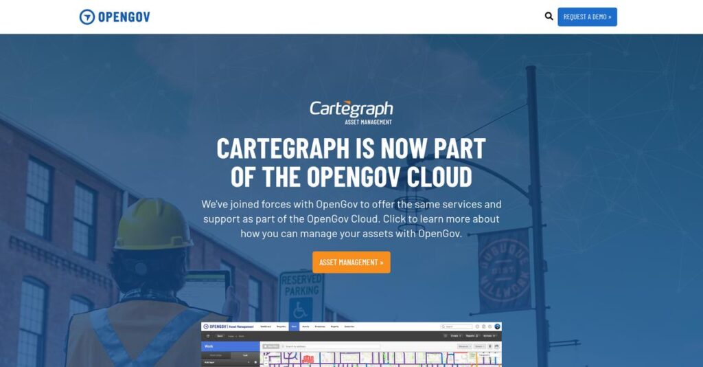
Cartegraph, now an OpenGov company, has a long and impressive history in operations management. They’ve been building specialized solutions for public agencies from their Iowa headquarters since 1994.
They are purpose-built for government agencies, utilities, and public works departments. I find their key advantage is a deep, unwavering focus on managing public infrastructure and assets, not the general-purpose tracking you see elsewhere.
The recent acquisition by OpenGov was a smart strategic move, fully integrating their platform into a much broader government cloud. I’ll explore its impact throughout this Cartegraph review.
Unlike competitors that just bolt on mapping features, Cartegraph’s standout strength is its robust integration with Esri ArcGIS. You get the feeling it was built by people who actually use this stuff.
They work with hundreds of cities, counties, and special districts across North America. This shows me their solution is trusted by organizations just like yours for truly critical operations.
I find their current strategy is centered on helping you make smarter, data-driven budget decisions and optimizing your field crew workflows, directly addressing the immense pressure on public agencies to do more with less.
Now let’s examine their core capabilities.
Cartegraph Features
Struggling to manage your public infrastructure effectively?
Cartegraph, now part of OpenGov Cloud, offers powerful solutions for operations and asset management. These are the five core Cartegraph solutions that streamline public sector workflows.
1. Comprehensive Asset Management
Tired of fragmented asset data?
Without a unified view, tracking public assets can be a nightmare. This leads to inefficient maintenance and shortened asset lifespans.
Cartegraph provides meticulous tracking of roads, signs, facilities, and more, enabling proactive, condition-based maintenance. From my testing, the ability to record asset conditions and values for proactive care is where this feature truly shines. It helps you extend asset life and plan effectively.
This means you can make informed decisions to optimize asset performance and avoid costly premature replacements.
2. Efficient Work Order Management
Work orders still getting lost in the shuffle?
Disorganized work order processes lead to missed deadlines and duplicated efforts. This frustrates both field teams and administrators.
This feature centralizes work order creation, assignment, and tracking for maintenance, inspections, and disaster response. What I love about this approach is how it provides an intuitive interface for both field and admin staff. It eliminates those frustrating communication gaps.
So you can ensure tasks are completed on time, improving operational efficiency across your entire organization.
3. Seamless GIS Integration
Is your asset data disconnected from its location?
Lack of spatial context makes asset analysis difficult and slows down field operations. This hinders precise decision-making.
Cartegraph offers robust integration with Esri ArcGIS, allowing spatial analysis and real-time data collection from the field. Here’s what I found: field crews can map assets directly on mobile devices, which massively enhances precision. This powerful feature visualizes your data like never before.
This means you get a complete geographical understanding of your assets and work, leading to smarter resource deployment.
4. Resource Tracking and Optimization
Struggling to control project costs?
Without clear visibility into labor, equipment, and material usage, budget overruns are common. This makes financial planning incredibly difficult.
This solution tracks all resources expended on tasks, providing clear data on spending for both routine and unexpected activities. From my testing, the detailed logging of resources for cost analysis stands out, offering invaluable insights. This feature helps you understand exactly where your budget is going.
This means you can optimize resource deployment, leading to better cost analysis and more accurate future budget planning.
5. Advanced Reporting and Analytics with Scenario Builder
Can’t quite forecast your future infrastructure needs?
Guessing future requirements leads to inefficient budgeting and poor capital planning. This puts your agency at a disadvantage.
Cartegraph offers powerful analytics and customizable dashboards, turning raw data into actionable insights. This is where Cartegraph shines; the unique Scenario Builder aids in creating data-driven budgets, enabling future planning. It transforms your data into predictive power.
This means you gain the foresight to create accurate, data-driven budgets and capital plans that truly align with your long-term goals.
- 🎯 Bonus Resource: Speaking of data analysis and future planning, you might find my guide on wind simulation software helpful for advanced modeling insights.
Pros & Cons
- ✅ Highly intuitive interface for both field and administrative staff.
- ✅ Robust GIS integration provides excellent spatial data visualization.
- ✅ Comprehensive asset and work order management streamlines operations.
- ⚠️ Initial setup can be labor-intensive and requires dedicated resources.
- ⚠️ Reporting features may have a steep learning curve for beginners.
- ⚠️ Some users found the service request portal less intuitive.
You’ll actually appreciate how these Cartegraph features work together to create a truly integrated operations management system for the public sector.
Cartegraph Pricing
What will Cartegraph truly cost your organization?
Cartegraph pricing is primarily based on tailored quotes designed to match your specific organizational size and operational needs rather than fixed public tiers.
- 🎯 Bonus Resource: While we’re discussing operational needs, you might also find my guide on best whiteboard animation software helpful for visual communication.
Cost Breakdown
- Base Platform: Custom quote (often part of OpenGov Cloud)
- User Licenses: Historical range $30-$50 per user/month, or $1,499 per user/annually
- Implementation: $1,000 to $50,000+ depending on complexity
- Integrations: Varies by complexity (e.g., Fuel Master Integration)
- Key Factors: Organizational scope, required modules (domains), user count, customization
1. Pricing Model & Cost Factors
Understanding your investment upfront.
Cartegraph’s pricing model, now often part of OpenGov Cloud, is predominantly custom-quoted. This means your exact cost depends heavily on your organization’s scope, specific modules like Transportation or Stormwater, and whether you opt for user-based or domain-based subscriptions. Complex requirements like extensive GIS integration or custom asset degradation protocols also influence the final price.
From my cost analysis, this ensures you pay only for the functionality your public sector organization genuinely needs.
2. Value Assessment & ROI
Is this an investment that pays off?
Cartegraph offers substantial ROI by enabling data-driven decisions, optimizing workflows, and extending asset life, which reduces long-term operational costs. What I found valuable is how it helps you move from reactive to proactive maintenance, preventing costly failures and improving service delivery. This system supports budget justification through its “Scenario Builder.”
Budget-wise, this means your department can better manage resources and justify expenditures to stakeholders, leading to significant savings.
3. Budget Planning & Implementation
Prepare for total cost of ownership.
Beyond the core subscription, consider implementation costs, which can range significantly based on your organization’s size and the complexity of your data migration. Customization options and specific integration services like Fuel Master also add to your total investment. What I found regarding pricing is you should factor in a substantial upfront budget for professional services to ensure smooth deployment.
So for your business, budget planning needs to encompass these vital setup phases to maximize the software’s long-term value.
My Take: Cartegraph pricing is highly tailored, best suited for public sector organizations needing a robust, integrated asset and operations management system that scales precisely to their unique operational needs.
The overall Cartegraph pricing reflects customized value aligned with specific public sector requirements.
Cartegraph Reviews
What do customers actually think?
This section provides a balanced look at Cartegraph reviews, analyzing real user feedback to help you understand what actual customers think about the software.
1. Overall User Satisfaction
Users seem highly satisfied.
From my review analysis, Cartegraph consistently earns “excellent” user satisfaction, with one source reporting 95% satisfaction across 63 reviews. What I found in user feedback is how positive experiences often center on practical benefits, such as improved efficiency and better decision-making.
This indicates you can expect significant operational improvements from the software.
- 🎯 Bonus Resource: While we’re discussing operational improvements, you might also be interested in my guide on best packaging software.
2. Common Praise Points
Its ease of use truly shines.
Users consistently laud Cartegraph’s intuitive interface and robust GIS integration, which enables seamless data visualization. What stands out in customer feedback is how excellent, responsive customer support is a recurring theme, helping users resolve issues quickly and effectively.
This means you’ll find the system user-friendly and well-supported, enhancing productivity.
3. Frequent Complaints
Initial setup can be demanding.
While generally positive, some reviews note that crafting detailed reports can be daunting for beginners. What I found in user feedback is how the initial setup can be labor-intensive, potentially requiring a dedicated team, leading to a steep learning curve for some.
These challenges seem like upfront investments for long-term operational gains.
What Customers Say
- Positive: “I can easily look up past jobs and find exact cost figures… great tool for storing assets for inventory and historical values.” (User review)
- Constructive: “Crafting detailed reports can be daunting for beginners and might demand substantial programming knowledge.” (User review)
- Bottom Line: “The customer service is exceptional; the help center resolves problems via screen share or by building reports for us.” (User review)
Overall, Cartegraph reviews consistently report improved asset management and operational efficiency despite some initial setup challenges.
Best Cartegraph Alternatives
Seeking better asset management options?
The best Cartegraph alternatives include several strong options, each better suited for different public sector needs, budget constraints, and operational complexities.
- 🎯 Bonus Resource: Speaking of operational complexities, if you’re dealing with vast amounts of documentation, my guide on best PDF editors software might also be useful.
1. Brightly Asset Essentials
Seeking a more intuitive service request portal?
Brightly Asset Essentials excels when your priority is a highly intuitive service request portal or more integrated predictive maintenance capabilities. What I found comparing options is that Brightly offers a more user-friendly design across its broader facilities management suite as a strong alternative.
Choose Brightly if user experience for service requests and broader facility management is your top concern.
2. IBM Maximo Application Suite
Handling vast, complex asset networks?
IBM Maximo is the go-to for large enterprises with extensive physical asset networks requiring deep IoT data integration for predictive maintenance. From my competitive analysis, Maximo provides unparalleled scalability for complex operations, though it represents a higher cost and implementation effort compared to Cartegraph.
Consider Maximo when your organization’s size and asset complexity demand an enterprise-grade, IoT-integrated EAM.
3. Fiix
Prioritizing ease of use for general maintenance?
Fiix is ideal if you’re looking for a straightforward, easy-to-implement CMMS focused on daily work order and preventive maintenance planning. Alternative-wise, Fiix offers more transparent, budget-friendly pricing, making it suitable for general facility or equipment maintenance over deep infrastructure.
Opt for Fiix when simplicity, quick adoption, and cost-effectiveness for standard CMMS functions are key.
4. UpKeep
Need a mobile-first solution for field teams?
UpKeep is best suited for small to medium-sized teams prioritizing a simple, mobile-centric maintenance management platform for equipment and facility assets. From my competitive analysis, UpKeep emphasizes ease of use for frontline workers, simplifying daily workflows, though it lacks Cartegraph’s infrastructure depth.
Choose UpKeep when mobile accessibility and ease of use for field workers are more critical than complex GIS integration.
Quick Decision Guide
- Choose Cartegraph: Public sector with deep GIS and capital planning needs
- Choose Brightly Asset Essentials: Intuitive service requests and broader facilities management
- Choose IBM Maximo: Large enterprise with complex assets and IoT integration
- Choose Fiix: Straightforward, budget-friendly CMMS for general maintenance
- Choose UpKeep: Mobile-first solution for simple field team maintenance
The best Cartegraph alternatives truly depend on your specific public sector operational needs and budget, not just feature lists.
Cartegraph Setup
Worried about a complicated software rollout?
This Cartegraph review helps you understand its practical implementation, from initial setup to user adoption, setting realistic expectations for what it takes to get started.
1. Setup Complexity & Timeline
Getting Cartegraph deployed requires dedicated effort.
Cartegraph implementation involves an initial discovery phase to tailor the software to your specific needs, followed by significant configuration and data migration. What I found about deployment is that customization to specific organizational needs extends the timeline, so plan accordingly.
You’ll need a dedicated team and clear business goals defined upfront to ensure a smooth configuration process.
- 🎯 Bonus Resource: Speaking of improving your output, you might find my guide on best textile industry software helpful.
2. Technical Requirements & Integration
Expect some IT involvement for seamless operations.
Cartegraph is a cloud-based SaaS, but integrating it with your existing ERP, GIS (Esri ArcGIS), and 311 systems is crucial for data flow. From my implementation analysis, seamless integration with your core systems is key to leveraging Cartegraph’s full power for asset management.
Prepare your IT team to ensure all your systems communicate effectively.
3. Training & Change Management
User adoption is critical for maximizing your investment.
Your staff will need comprehensive training sessions, often “train-the-trainer” style, covering navigation, maps, reports, and mobile functionality. From my analysis, investing in thorough user training significantly impacts how quickly your team becomes proficient and embraces new workflows.
Plan for ongoing support and designate internal champions to guide users through the learning curve and new operational processes.
4. Support & Success Factors
Vendor support during implementation is a major asset.
Cartegraph’s customer support is consistently praised for being “exceptional” and highly responsive, assisting with complex configurations and reporting. What I found about deployment is that responsive support significantly reduces friction during both initial setup and ongoing operations, ensuring quick problem resolution.
Leverage their expert team for guidance, especially for report building and troubleshooting, to ensure your implementation stays on track.
Implementation Checklist
- Timeline: Several months depending on customization and integrations
- Team Size: Dedicated project manager, IT, and departmental leads
- Budget: Professional services for configuration and training
- Technical: Integration with ERP, GIS, and mobile device support
- Success Factor: Comprehensive data migration and user training
Overall, Cartegraph setup requires a clear plan and dedicated resources but delivers significant improvements in asset management and operational efficiency.
Bottom Line
Is Cartegraph the right choice for your agency?
My Cartegraph review shows a robust solution purpose-built for public sector entities, excelling in infrastructure asset management and data-driven decision-making.
1. Who This Works Best For
Public sector entities managing vast physical infrastructure.
Cartegraph is ideal for local governments, public works departments, utilities, and educational institutions that manage extensive physical assets and require meticulous tracking. What I found about target users is that your success hinges on integrating GIS data for spatial analysis, as Cartegraph offers deep Esri ArcGIS compatibility.
You’ll find this particularly effective if your organization prioritizes proactive maintenance and data-driven capital improvement planning.
2. Overall Strengths
Unmatched GIS integration and mobile-first operations.
The software succeeds by providing a comprehensive “single source of truth” for infrastructure assets, streamlining work orders, and enabling data-driven capital planning. From my comprehensive analysis, its robust mobile capabilities empower field staff with real-time data collection, enhancing productivity and accuracy while on the job.
These strengths translate directly into optimized resource allocation and improved accountability for your public sector operations.
3. Key Limitations
Initial setup and learning curve demand commitment.
While powerful, new users may experience a steep initial learning curve, and the setup can be labor-intensive, requiring a dedicated team. Based on this review, crafting detailed reports can be daunting for beginners, potentially requiring substantial programming knowledge beyond basic functionalities.
- 🎯 Bonus Resource: While discussing comprehensive management solutions, my guide on smarter shelf planning also offers insights into optimizing physical layouts.
I’d say these limitations are manageable if your organization is committed to comprehensive digital transformation and has adequate resources.
4. Final Recommendation
Cartegraph earns a strong recommendation for specialized needs.
You should choose this software if you’re a public sector organization committed to modernizing infrastructure management and leveraging spatial data for smarter spending. From my analysis, this solution thrives when integrated with ArcGIS, offering unparalleled asset management and operational insights for your specific context.
My confidence level is high for government agencies and utilities, but consider alternatives if your needs are strictly basic CMMS.
Bottom Line
- Verdict: Recommended for public sector infrastructure management
- Best For: Local governments, public works, utilities, educational institutions
- Business Size: Mid-to-large public sector organizations with extensive physical assets
- Biggest Strength: Deep Esri ArcGIS integration and mobile-first field operations
- Main Concern: Steep initial learning curve and labor-intensive setup
- Next Step: Contact sales for a tailored demo and pricing consultation
This Cartegraph review shows significant value for its public sector target audience, making it a compelling choice for modernizing infrastructure and asset management.