Too many disconnected spreadsheets causing confusion?
If you’re evaluating Cityworks, you’re probably dealing with siloed asset data, manual work orders, and inefficient coordination between your teams and field crews.
Let’s be honest, field crews are constantly lost in missing or outdated information and you’re left fixing mistakes that hurt your city’s operations every single day.
Cityworks tackles this by tying asset management, permitting, and inventory tasks directly to GIS maps, giving you a single visual source of truth your whole organization can trust—from desks to field tablets.
In this review, I’ll walk you through how Cityworks actually streamlines your entire infrastructure workflow so you can finally focus on proactive management instead of putting out daily fires.
You’ll see in this Cityworks review how the platform handles everything from day-to-day asset tracking to permitting, pricing structure, mobile use, and even how Cityworks compares to competitors.
You’ll walk away with the features you need to make a confident, unbiased decision about Cityworks.
Let’s dive into the analysis.
Quick Summary
- Cityworks is a GIS-centric platform that helps local governments and utilities manage assets, work orders, and permitting.
- Best for public sector organizations needing integrated asset and community development tools.
- You’ll appreciate its deep integration with Esri ArcGIS for strong spatial asset management and field mobility.
- Cityworks offers custom enterprise pricing with demos available but no public trial information.
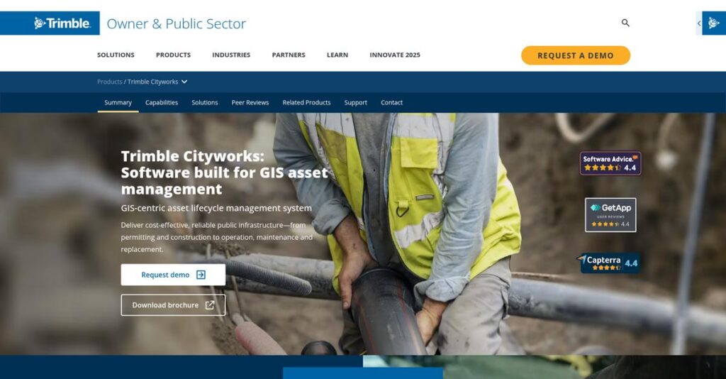
Cityworks Overview
I’ve found Cityworks to be a specialist in GIS-centric asset management. They’ve been around since 1986, based in Sandy, Utah, and are laser-focused on public works.
They primarily serve local governments and utilities. You’ll notice they laser-focus on GIS-centric asset management, building everything directly on Esri’s ArcGIS platform. This isn’t a general-purpose tool, which I see as a strength.
Their 2019 acquisition by Trimble was a smart move, folding them into a larger tech ecosystem. We’ll examine the impact of this through this Cityworks review.
Unlike competitors like IBM Maximo that treat GIS as an add-on, Cityworks’ whole approach is different. With them, the GIS is the authoritative system of record.
You’ll find them working with public works departments, city governments, and utility providers managing complex infrastructure networks where location is absolutely critical for daily operations.
- 🎯 Bonus Resource: While discussing managing complex infrastructure, my analysis of field service management software is equally important.
Their strategy seems to be doubling down on their GIS core while leveraging Trimble’s resources. This focus on a single source of geographic truth directly addresses your operational needs.
Now let’s examine their core capabilities.
Cityworks Features
Dealing with disconnected asset management?
Cityworks offers an integrated suite of GIS-centric solutions designed to help you manage public infrastructure efficiently. These are the five core Cityworks solutions that make a real difference.
1. Cityworks AMS (Asset Management System)
Struggling to track public assets effectively?
Managing the lifecycle of countless assets, from pipes to roads, can be an overwhelming task. This often leads to missed maintenance and costly breakdowns.
Cityworks AMS provides a comprehensive system for tracking assets, their data, and work activities. What I found remarkable is how it links all work directly to spatial information, allowing for visual management on maps. It streamlines preventative maintenance, service requests, and work order management, all from a central database.
This means you can easily schedule inspections, track repairs, and ensure your infrastructure remains in top condition, preventing future headaches.
- 🎯 Bonus Resource: While Cityworks focuses on public infrastructure, understanding medical practice management software can offer different management perspectives.
2. Cityworks PLL (Permits, Licensing, and Land)
Are complex permitting processes slowing you down?
Navigating permits and licenses can be a bureaucratic nightmare for both citizens and staff. This often leads to frustration and delays.
Cityworks PLL simplifies these processes, managing everything from application to approval. It ties all related documents and workflows to specific land parcels within your GIS. From my testing, this feature genuinely helps reduce bureaucratic hurdles and streamline workflows, making life easier for everyone involved.
The result is a more efficient permitting system that saves time, reduces paperwork, and improves citizen satisfaction for your community.
3. Cityworks Respond
Can field crews access critical data on the go?
Without real-time mobile access, field teams often struggle with outdated information. This can lead to inefficient work orders and delayed responses.
Cityworks Respond offers a modern, GIS-centric app for managing work orders, service requests, and inspections on any device. Here’s what I found: field crews can create and track work orders, capture digital signatures, and access asset details directly from their mobile phones, even with barcode scanning capabilities.
This means your team gets immediate access to vital information, improving collaboration and ensuring tasks are completed accurately and on time, wherever they are.
4. Cityworks Storeroom
Are you losing track of your inventory and materials?
Inefficient inventory management can lead to excess material costs or critical shortages. This directly impacts your budget and operational efficiency.
Cityworks Storeroom is a dedicated desktop application for tracking warehouse transactions and managing inventory securely. It helps you reduce material costs and improve inventory levels by closely monitoring incoming and outgoing materials. This solution provides vital data for budgeting and ensures you always have the right parts on hand.
You can finally get a clear picture of your stock, minimize waste, and make informed decisions about your material requisitions.
5. Cityworks Analytics
Struggling to gain insights from your operational data?
Raw data alone doesn’t tell a story, making it hard to make informed decisions about resource allocation. This can hinder strategic planning and accurate reporting.
Cityworks Analytics, running within Esri’s ArcGIS Insights, provides valuable operational insights by digesting your asset data. It offers workbook templates for work orders, service requests, and inventory. This is where Cityworks shines: visualizing data through maps and graphs helps you understand complex information quickly, leading to better decision-making.
This means you can easily analyze performance, identify trends, and accurately report on operations, optimizing your resource allocation.
Pros & Cons
- ✅ Excellent integration with GIS, especially Esri ArcGIS, for asset management.
- ✅ Robust capabilities for managing public assets and their complete lifecycle.
- ✅ Streamlines workflows for permitting, licensing, and field operations.
- ⚠️ Implementation can be complex, potentially requiring third-party support.
- ⚠️ The comprehensive nature may present a learning curve for new users.
- ⚠️ May be a larger, less cost-effective solution for very small organizations.
These Cityworks features work together, leveraging a central GIS database to provide a holistic view of your assets and operations.
Cityworks Pricing
Worried about complex software costs?
Cityworks pricing operates on a custom quote model, meaning you’ll need to contact their sales team for specific details, but this ensures pricing is tailored to your unique needs.
Cost Breakdown
- Base Platform: Custom quote
- User Licenses: Varies by volume
- Implementation: Significant investment (percentage not public)
- Integrations: Varies by complexity and existing systems
- Key Factors: Number of users, modules, asset complexity, integration level
1. Pricing Model & Cost Factors
Their pricing approach is bespoke.
Cityworks utilizes a custom pricing model, reflecting its enterprise-level focus and the need for solutions tailored to specific municipal or utility operations. Pricing factors include your organization’s size, chosen modules (AMS, PLL, Storeroom), number of users, and the complexity of integrating with existing GIS and business systems.
From my cost analysis, this means your total investment scales directly with the solution’s scope and the value it delivers.
2. Value Assessment & ROI
Does this justify the cost?
Cityworks represents a significant investment, but its GIS-centric approach and comprehensive asset management capabilities can drive substantial ROI for public sector organizations. You gain deep operational insights that reduce maintenance costs, improve service delivery, and enhance infrastructure longevity, far surpassing manual methods.
Budget-wise, this means you’re investing in long-term efficiency and better community outcomes, not just software.
3. Budget Planning & Implementation
Consider all your expenses carefully.
Beyond the custom quote for the software itself, anticipate substantial costs for implementation, data migration, user training, and ongoing support. What I found regarding pricing indicates total cost of ownership involves significant upfront integration and configuration efforts, given the deep GIS dependency and customizability.
So for your budget, plan for a comprehensive long-term investment, not just a recurring subscription fee, to ensure full success.
My Take: Cityworks pricing is positioned for large-scale, complex asset management, making it best suited for mid-to-enterprise level public sector organizations that need a deeply integrated GIS solution.
The overall Cityworks pricing reflects a strategic enterprise investment for robust asset management.
Cityworks Reviews
What do real customers actually think?
To help you understand real-world experiences, I’ve analyzed various Cityworks reviews to synthesize what actual users say about the software’s performance and usability.
1. Overall User Satisfaction
Users seem genuinely happy here.
From my review analysis, Cityworks enjoys a largely positive sentiment, with high satisfaction ratings, including 100% 5-star reviews on Gartner Peer Insights for AMS. What stands out is how users consistently praise its deep integration with GIS, particularly Esri ArcGIS, as a significant advantage.
- 🎯 Bonus Resource: While we’re discussing system reliability, understanding how effective meeting management software can help streamline collaboration is equally important.
This indicates you can expect a highly functional and reliable system for asset management.
2. Common Praise Points
The GIS-centric approach wins users over.
Users consistently highlight how well Cityworks integrates with their GIS data, enhancing asset management and visualization. From my review analysis, the ability to manage public assets and accompanying data is frequently cited as a major strength, streamlining complex workflows.
This means you’ll find it effective for organizing incoming customer information and resolving issues promptly.
3. Frequent Complaints
Implementation can be a bumpy road.
While integration is lauded, some users point out the critical importance of thoroughly researching GIS data compatibility and careful setup. What I found in user feedback is how implementation complexity often necessitates third-party consultant support, suggesting a significant initial undertaking.
These concerns suggest that upfront planning and potential external expertise are key considerations for you.
What Customers Say
- Positive: “Integrates well with our GIS database.” (Gartner)
- Constructive: “Thoroughly research GIS data compatibility before using CityWorks.”
- Bottom Line: “Great product for the asset management, 100% recommend.”
The overall Cityworks reviews reflect strong user satisfaction tempered by implementation considerations for new users.
Best Cityworks Alternatives
Which Cityworks alternative is best for you?
The best Cityworks alternatives offer distinct advantages, each better suited for specific organizational structures, integration priorities, and budget considerations.
1. IBM Maximo Application Suite
Need advanced, broad-spectrum asset management?
Maximo excels if your organization requires a highly customizable EAM solution across diverse industries and asset types, prioritizing advanced AI/IoT for predictive maintenance. From my competitive analysis, Maximo offers comprehensive asset lifecycle management that extends beyond the public works focus of Cityworks, though it’s typically a higher investment.
- 🎯 Bonus Resource: While we’re discussing asset management, understanding donation management software is equally important for non-profits.
Choose Maximo when broad industry applicability and predictive maintenance are top priorities for your enterprise.
2. Accela
Seeking a broader government service platform?
Accela makes more sense if your primary need is a comprehensive platform for civic services, including extensive permitting, licensing, and code enforcement, with asset management as one component. What I found comparing options is that Accela offers a wider government software suite, making it ideal if your scope extends beyond pure asset management.
Consider this alternative when comprehensive civic engagement solutions are as critical as asset management.
3. Cartegraph
Looking for GIS-integrated operational efficiency?
Cartegraph is a strong alternative for local governments seeking robust asset and work management with GIS integration, potentially with a different approach to asset valuation or specific reporting. Alternative-wise, Cartegraph focuses on operational efficiency for public works, similar to Cityworks but with nuanced differences in financial asset tracking.
Choose Cartegraph if you are a local government prioritizing operational efficiency and specific reporting requirements.
4. CentralSquare (Lucity)
Prioritizing user interface and good ArcGIS integration?
CentralSquare (formerly Lucity) can be a strong option if your organization seeks an asset management system with good ArcGIS integration and a potentially more appealing user interface. From my analysis, Lucity offers a different user experience with solid ArcGIS integration, though it’s not as deeply GIS-centric as Cityworks.
Consider this alternative if UI is a key factor and you appreciate CentralSquare’s overall product ecosystem.
Quick Decision Guide
- Choose Cityworks: Deep, native GIS-centric public works and utilities management
- Choose IBM Maximo: Broad industry EAM with advanced AI/IoT and predictive maintenance
- Choose Accela: Comprehensive government suite for permitting and civic services
- Choose Cartegraph: Local government asset and work management with strong GIS
- Choose CentralSquare: Asset management with good ArcGIS integration and different UI
The best Cityworks alternatives depend on your organization’s specific needs and existing GIS investment rather than generic features.
Cityworks Setup
How complex is Cityworks to implement?
The Cityworks review indicates that deploying this robust GIS-centric platform requires careful planning and a realistic understanding of its comprehensive nature. It’s not a simple, overnight installation.
1. Setup Complexity & Timeline
This isn’t a quick setup.
Cityworks implementation involves critical GIS data compatibility research, precise data setup for long-term success, and thorough system configuration. What I found about deployment is that complexity scales with your organization’s unique requirements, often benefiting from specialized third-party consultant assistance.
You’ll need to allocate significant time and internal resources to properly configure your data and integrate the system.
2. Technical Requirements & Integration
Prepare for considerable technical effort.
Your team will need to ensure compatibility with Esri ArcGIS Server, Microsoft Office, and industry-standard databases like SQL Server or Oracle. From my implementation analysis, a constant network connection is vital for real-time updates and advanced map functionality within Cityworks Respond.
Plan for robust IT infrastructure and skilled technical personnel to manage server setups, database configurations, and network connectivity.
- 🎯 Bonus Resource: While ensuring robust IT infrastructure, you might also find my analysis of best construction drawing management software helpful for project documentation.
3. Training & Change Management
User adoption requires strategic planning.
Staff will face a learning curve, particularly those new to GIS concepts, and will need training on specific modules like AMS, PLL, or Storeroom. From my analysis, successful change management ensures smooth transition as users learn how to leverage GIS data within their new workflows effectively.
Invest in tailored training programs and communicate the benefits clearly to secure user buy-in and maximize system utilization.
4. Support & Success Factors
Vendor support is a key success enabler.
Trimble (Cityworks) generally receives positive reviews for service and support, offering documentation and resources, including module guides. From my implementation analysis, proactive engagement with support ensures smoother deployment and addresses challenges efficiently throughout the setup process.
Plan to leverage their support channels and internal champions to troubleshoot issues and drive optimal configuration for long-term success.
Implementation Checklist
- Timeline: Several months (highly dependent on complexity)
- Team Size: Dedicated project manager, IT, GIS, and departmental leads
- Budget: Software cost plus significant professional services and training
- Technical: Esri ArcGIS Server, database compatibility, strong network
- Success Factor: Thorough GIS data compatibility research and data setup
Overall, Cityworks setup demands significant upfront planning and resource allocation, but this investment yields substantial returns in asset management efficiency.
Bottom Line
Is Cityworks the right fit for your organization?
This Cityworks review synthesizes its strengths and limitations, guiding you to understand if this GIS-centric solution aligns with your public infrastructure management needs.
1. Who This Works Best For
Public sector and utility organizations.
Cityworks excels for local governments and utilities managing extensive public infrastructure, needing robust asset management, work order automation, and community development tools. What I found about target users is that entities deeply invested in Esri ArcGIS will find the most seamless integration and value from this powerful platform for their large asset bases.
Your team will find this works well if you require a comprehensive, GIS-centric system to streamline operations and enhance public service.
2. Overall Strengths
Unparalleled GIS integration and asset management.
The software succeeds by offering deep, exclusive integration with Esri ArcGIS, providing comprehensive asset lifecycle management, streamlined permitting, and real-time data visibility. From my comprehensive analysis, its GIS-centric approach optimizes infrastructure management for public works and utility departments, leading to significant operational efficiencies and cost savings.
These strengths will translate into improved data visibility and streamlined workflows, allowing your organization to make more informed decisions.
3. Key Limitations
Implementation can be complex.
While powerful, Cityworks’ comprehensive nature means implementation can be intricate, often requiring careful GIS data setup and potentially third-party consulting. Based on this review, the learning curve for comprehensive utilization might be a factor for teams without prior experience in complex enterprise solutions or dedicated GIS expertise for initial setup.
I’d say these limitations are manageable trade-offs for the robust capabilities you gain, not fundamental barriers to success.
4. Final Recommendation
Cityworks earns a strong recommendation.
- 🎯 Bonus Resource: Speaking of management solutions, my guide on classroom management software offers additional insights.
You should choose this software if your organization is a mid-to-enterprise level public agency or utility with substantial infrastructure and a commitment to the Esri ArcGIS ecosystem. From my analysis, this solution best supports complex, integrated workflows for asset lifecycle management and community development, justifying the investment.
My confidence level is high for its target audience seeking a robust, long-term infrastructure management solution.
Bottom Line
- Verdict: Recommended for public sector and utilities
- Best For: Organizations with extensive public infrastructure and Esri ArcGIS investment
- Business Size: Mid-market to enterprise-level organizations
- Biggest Strength: Deep, exclusive GIS-centric integration with Esri ArcGIS
- Main Concern: Complex implementation and potential learning curve
- Next Step: Request a custom demo to assess specific fit
This Cityworks review highlights its strong value for public infrastructure management, especially for organizations with existing GIS investments looking for a comprehensive, integrated solution.