Are your routes truly optimized?
When your routes are inefficient and customer targeting is off, you’re leaving money on the table. It’s a frustrating position for any operations analyst.
The real issue is making sense of overwhelming spatial data. Without the right tools, it’s hard to turn raw location points into profitable actions.
You aren’t alone in facing this. A report from Precisely found a 62% year-over-year increase in prioritizing spatial analytics. Companies are actively addressing these location-based inefficiencies.
The good news is that the right tool transforms this challenge into a strategic advantage, helping you refine routes and deepen insights.
Beyond location insights, ensuring digital privacy compliance is equally vital for a holistic business strategy.
In this article, I’ll help you cut through the overwhelming choices. I’m breaking down the best location intelligence software to find the perfect fit for you.
You’ll find tools that optimize logistics and provide clear insights, saving your business time and money without requiring heavy IT support.
Let’s dive in.
Quick Summary:
| # | Software | Rating | Best For |
|---|---|---|---|
| 1 | Placer.ai → | Retail & enterprise analysts | |
| 2 | CARTO → | Cloud-first large enterprises | |
| 3 | Precisely → | Operations & marketing teams | |
| 4 | Geoblink → | Retail & real estate pros | |
| 5 | Maptive → | Mid-sized marketing & ops |
1. Placer.ai
Struggling with unclear market trends?
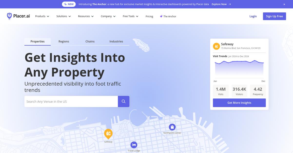
Placer.ai offers an analytics platform providing best-in-class location intelligence for strategic business decisions. This means you can gain unprecedented visibility into crucial foot traffic patterns.
You can unlock deep insights into locations, brands, and enterprises, empowering you to optimize performance and drive growth. Here’s how it helps.
Navigate complex business landscapes confidently.
Placer.ai solves your challenges by giving you powerful insights built on reliable data, helping you understand the physical world better. Its analytics platform lets you explore property, chain, and industry-level reports and create custom reports directly on the UI. For instance, you can track migration patterns and explore population changes across regions to understand evolving demand. Additionally, the API allows you to programmatically ingest their data into your own tech stack for deeper integration. Plus, Placer.ai offers specialized reports through XTRA from their data experts, ensuring you get the exact insights you need.
This allows you to make informed, data-driven decisions.
Key features:
- Analytics Platform: Offers strategic location intelligence with property, chain, and industry-level reports, along with customizable reporting directly on the user interface.
- Data Marketplace & API: Provides access to advanced in-house and partner datasets for enriching applications and custom reports, seamlessly integrating with your existing tech stack.
- Free Tools & Resources: Includes features like Chain Analysis, Industry Trends, and Migration Trends, plus a library of in-depth reports and case studies for actionable insights.
Placer.ai features, pricing, & alternatives →
Verdict: Placer.ai stands out as a strong contender for the best location intelligence software, empowering your business to gain competitive advantages by understanding foot traffic trends and market share. With powerful tools like Chain Analysis and the ability to track migration patterns, Placer.ai helps optimize store performance and enhances product distribution.
2. CARTO
Struggling with spatial data overload and complex analysis?
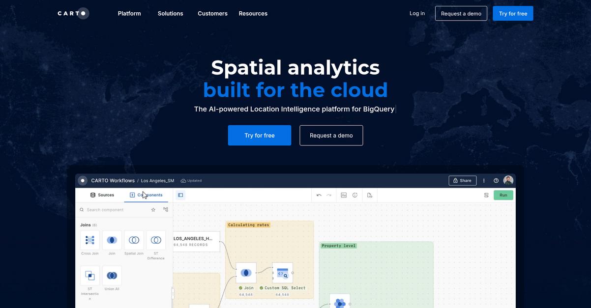
CARTO offers a powerful AI-powered Location Intelligence platform built for the cloud, specifically designed to help you analyze vast amounts of data quickly. This means you can easily visualize billions of data points and share interactive maps and dashboards with your team and stakeholders, moving beyond static reports. You gain a flexible and seamless analytics experience.
This allows you to gain deep insights without needing extensive IT resources.
CARTO seamlessly integrates with your cloud ecosystem, including Google Cloud, AWS, Snowflake, and Azure, ensuring unparalleled speed and scalability without data silos or complex ETLs. You can leverage 100+ ready-to-go analysis components and native ML/AI integrations for powerful, low-code spatial analysis with automated drag-and-drop interfaces. Additionally, CARTO’s AI Agents provide geospatial reasoning at scale, allowing you to create custom agents and interact with maps and data using natural language, supporting integrations with OpenAI, Gemini, and Cortex. This accelerates scalable app development, running apps directly in your data lakehouse without backend ETLs.
Unlock precise geospatial insights for your business.
If you’re also looking to gather external information, my article on web scraping tools for market data offers valuable strategies.
Key features:
- Cloud-native platform: Offers unparalleled speed and scalability by integrating directly with your existing cloud data warehouses like Google Cloud, AWS, and Snowflake, eliminating data silos.
- AI-powered analytics: Provides over 100 ready-to-go analysis components, native ML/AI integrations, and AI Agents for natural language interaction with spatial data, simplifying complex analysis.
- Advanced visualization: Allows you to visualize billions of data points with ease through interactive maps and dashboards, facilitating enterprise-scale collaboration and data sharing.
CARTO features, pricing, & alternatives →
Verdict: CARTO stands out as a best location intelligence software solution, especially for those seeking to unify spatial analytics within their cloud environment. Its robust AI capabilities, seamless data integration, and intuitive visualization tools allow your teams to move from intuition-based to data-driven decisions, as seen in cases like Vodafone and Renault.
3. Precisely
Struggling with inconsistent location data ruining your insights?
Precisely offers a robust Data Integrity Suite that allows you to integrate, verify, locate, and enrich your data with precision. This means you can finally trust the data guiding your operational efficiency and customer targeting.
Your marketing, operations, and logistics teams can achieve unparalleled accuracy in route planning and customer segmentation, addressing key pain points in data reliability.
Get ready for truly trusted data.
Precisely addresses your need for accurate and contextual location data through its “Locate” and “Enrich” capabilities, turning raw data into actionable insights for improved decision-making. These tools support powerful geocoding and spatial analytics, ensuring your route planning is optimized and customer targeting becomes much more effective. Additionally, “Verify” products like Spectrum Global Addressing and Trillium Geolocation help to ensure the quality and accuracy of your location information, essential for maintaining compliance with privacy regulations like GDPR. With solutions for diverse industries from retail to telecommunications, you can tailor the software to your specific needs, enhancing operational efficiency and customer engagement.
Precise data powers smarter decisions.
While we’re discussing enhancing customer engagement, if you work in healthcare, my guide on best patient engagement software is essential reading.
Key features:
- Locate and Spatial Analytics: Utilize advanced geocoding and spatial analytics to gain actionable insights from location data, improving route planning and logistical efficiencies.
- Data Quality and Validation: Ensure the accuracy and consistency of your address data globally, crucial for reliable customer segmentation and regulatory compliance.
- Data Enrichment and Insights: Enhance your decision-making with enriched demographic, boundary, and points of interest data, deepening your customer understanding for targeted campaigns.
Precisely features, pricing, & alternatives →
Verdict: Precisely stands out as a best Location Intelligence Software, offering a comprehensive suite that integrates, verifies, locates, and enriches your data. This empowers operations and marketing professionals to achieve precise route optimization, superior customer targeting, and robust spatial analytics, making it a reliable choice for data-driven decisions.
4. Geoblink
Are your location strategies truly maximizing your potential?
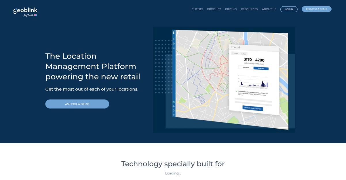
Geoblink centralizes your business and third-party data, providing a 360-degree view of your locations. This helps retail, real estate, and consumer goods professionals identify what truly impacts sales.
This means you can easily unify and visualize all your point of sale and external data in one place, providing a complete picture of your network’s health.
It’s time to unlock your full network potential.
Geoblink empowers you to gain strategic insights instantly, allowing you to roll out tailored action plans for maximum success. It enriches your internal data with premium location data, giving you full context about what’s happening around your sites.
Your team gets automatic alerts on problems and opportunities across your network, enabling immediate action. This ensures you apply the right measures proactively. You can tailor action plans by site, engage the right people, and even revamp your product mix or relocate to optimal spots.
This comprehensive approach helps you monitor spending, footfall, and competitor movements, ensuring your locations reach their full potential, from catchment area to territory level.
Maximize performance with precise insights.
While we’re discussing optimizing customer interactions in physical spaces, my article on best Android kiosk software offers further insights.
Key features:
- Seamless Data Integration: Centralize your business and third-party data, including spending and footfall, to visualize and monitor performance in one unified location.
- Operable Insights & Alerts: Receive automatic notifications about problems and opportunities across your network, enabling quick and precise application of corrective measures for success.
- Strategic Plan Roll-Out: Tailor action plans specifically for each site, involve relevant personnel, and optimize product mixes or consider relocation based on real-world data.
Geoblink features, pricing, & alternatives →
Verdict: If you’re seeking the best location intelligence software to unify diverse data sources and gain precise, actionable insights for retail expansion and optimization, Geoblink delivers. It helps you proactively manage your network, ensuring each location reaches its full sales potential and addressing issues before they become larger problems.
5. Maptive
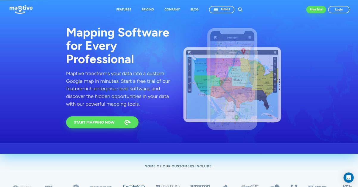
Are you struggling to visualize your crucial location data? Maptive transforms your raw data into custom Google Maps in minutes.
This means you can easily upload spreadsheets and immediately see hidden opportunities in your data.
You’ll find Maptive proves that GIS mapping software doesn’t have to be complicated, helping you avoid costly implementation errors or post-purchase adoption issues.
Here’s how Maptive helps you.
Maptive empowers you to make sense of your data and boost productivity significantly. The cloud-based solution means no downloads, always updated features, and access from any device.
You can optimize routes for field reps, create heat maps, and plot up to 100,000 locations with a few clicks. Additionally, the software allows you to customize maps for internal analysis, presentations, or public sharing, making data visualization simple. You can even draw custom sales territories, integrate demographic data, and create drive-time polygons to understand market reach.
The result? Better decision-making and operational efficiency.
While we’re discussing enhancing sales and marketing, you might also find my analysis of best account based marketing software helpful for pipeline growth.
Key features:
- Intuitive Design & Accessibility: Easily transform spreadsheet data into custom Google Maps with no coding required, accessible from any device.
- Powerful Map Analysis Tools: Optimize routes, generate heat maps, plot thousands of locations, and create sales territories with demographic overlays for deeper insights.
- Customization & Sharing Options: Personalize maps with custom markers and styles, then share privately, publish publicly, embed on websites, or export for print.
Maptive features, pricing, & alternatives →
Verdict: Maptive stands out as a leading best location intelligence software solution, simplifying complex spatial analysis for marketing, operations, and logistics professionals. Its intuitive design, powerful mapping tools for route optimization and sales territory creation, and robust security features make it an ideal choice for mid-sized companies seeking to enhance operational efficiency and deepen customer insights.
6. Esri
Struggling with complex spatial data and route optimization?
Esri offers ArcGIS, the premier GIS mapping software for deeper insights.
This comprehensive geospatial platform empowers you to accelerate automation, prediction, and optimization across your operations.
Here’s how Esri helps.
Esri helps you transform regional planning and expand into new markets. Their technology is the foundation for essential data sharing and collaboration.
You can use market analysis powered by their GIS mapping software to find the right locations for business growth. This enables you to visualize designs in geographic context and efficiently track issues.
Additionally, Esri’s ArcGIS Location Platform delivers mapping APIs, SDKs, and location services to bring location capabilities directly into your applications. This powerful integration capability, along with drone mapping powered by ArcGIS Reality, helps you unlock new operational efficiencies at any scale.
It truly deepens your insights.
While we’re discussing operational efficiency, you might find my article on best virtual agent software helpful for automating customer interactions.
Key features:
- Comprehensive geospatial platform: Access a full suite of GIS mapping software and tools to support your daily operations and long-term strategies.
- Geospatial AI integration: Leverage AI-enriched technology to accelerate automation, prediction, and optimization, delivering deeper insights at scale.
- Location platform for apps: Utilize ArcGIS Location Platform’s APIs, SDKs, and services to seamlessly embed mapping and location capabilities into your own applications.
Esri features, pricing, & alternatives →
Verdict: Esri’s focus on comprehensive geospatial intelligence, augmented by AI and robust integration capabilities, makes it an excellent choice for businesses seeking the best location intelligence software. Their technology helps organizations like The Joint expand into new markets by guiding growth decisions with precise market analysis.
7. Mapbox
Struggling with route optimization or customer targeting?
Mapbox offers smooth, cross-platform maps, custom navigation, and smart location data to refine your operations.
This means you can visualize properties, enhance data analysis, and improve service delivery for your business.
Here’s how Mapbox provides comprehensive solutions.
You can build custom maps for web, mobile, automotive, and AR with Mapbox APIs and SDKs, using ready-made map styles and live updating data. This allows your team to create immersive and customized experiences.
Additionally, Mapbox provides advanced routing engines, accurate traffic-aware travel times, and intuitive turn-by-turn directions for mobile and automotive use. This functionality ensures efficient logistics and on-time arrivals, helping you reduce costs and enhance customer satisfaction for millions of deliveries, as seen with their 88% engineer efficiency boost for Kraken Technologies. Plus, Mapbox powers location search for precise addresses and points of interest.
The result: Mapbox empowers you to achieve operational efficiency.
Key features:
- Customizable Maps: Build beautiful, tailored maps for web, mobile, automotive, and AR using Mapbox APIs, SDKs, and Studio, enhancing your location intelligence visualizations.
- Optimized Navigation: Access advanced routing engines, real-time traffic data, and precise turn-by-turn directions for mobile and automotive applications, improving delivery and fleet efficiency.
- Comprehensive Location Data: Utilize global datasets for boundaries, traffic, and movement patterns, informed by over half a billion monthly active users, to generate deep geospatial insights.
Mapbox features, pricing, & alternatives →
Verdict: Mapbox stands out as a best Location Intelligence Software, offering robust mapping, navigation, and search capabilities. Its ability to provide customizable routing, precision geocoding, and real-time traffic data, exemplified by an 88% efficiency boost for Kraken Technologies, makes it ideal for optimizing logistics and improving customer satisfaction for your growing mid-sized company.
8. espatial
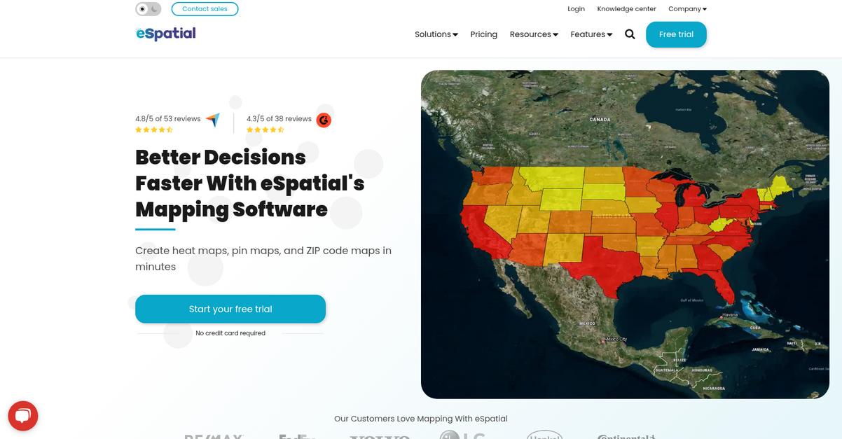
Struggling with fragmented data and inefficient operations?
eSpatial helps you visualize customers, sales, and critical business data on maps, directly addressing your need for clearer insights.
This means you can easily identify growth areas or optimize territories without information overload, making complex decisions simpler and faster.
It’s time for better decisions, faster.
eSpatial allows you to create heat maps, pin maps, and ZIP code maps in minutes, directly from your spreadsheet data. This helps you overcome data integration challenges by plotting points quickly and easily.
You can also use tools like the route planning tool, territory optimization tool, and the scenario planning tool. These capabilities enable you to visualize, optimize, and analyze routes to identify inefficiencies and create balanced territories, improving productivity and reducing logistics costs. Additionally, the software supports Salesforce integration for a connected workflow, ensuring your spatial analysis is always aligned with your CRM data.
This comprehensive approach helps you uncover hidden opportunities and sell smarter.
While we’re discussing uncovering insights, understanding user behavior insights is equally important for optimizing your product.
Key features:
- Intuitive Mapping Tools: Create pin maps, heat maps, radius maps, and ZIP code maps quickly to visualize customer data and market trends.
- Route and Territory Optimization: Plan the most efficient routes and design, assign, or realign sales and service territories for balanced workloads.
- Advanced Scenario Planning: Use map analytics and the scenario planning tool to create data stories and make informed decisions on new alignments.
espatial features, pricing, & alternatives →
Verdict: If you are looking for the best location intelligence software to optimize routes, manage territories, and gain quick insights from complex data, eSpatial offers powerful mapping capabilities. Its user-friendly interface, robust optimization tools, and features like territory optimization and scenario planning are highly suitable for operations, sales, and marketing managers looking to make data-driven decisions and boost productivity.
9. Smappen
Struggling to find your business’s next perfect spot?
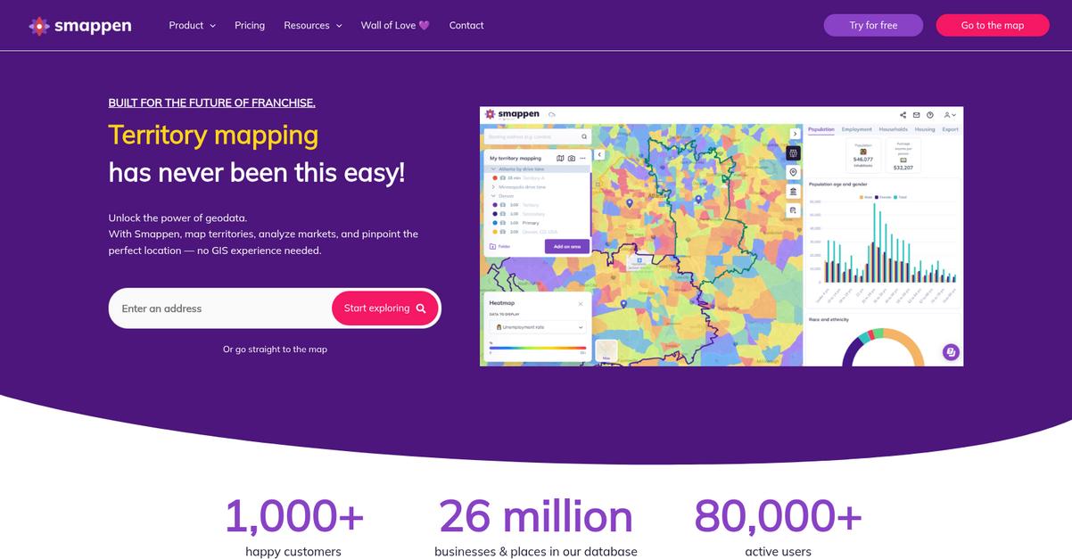
Smappen’s territory mapping features help you effortlessly define and manage sales or franchise areas, offering clear performance insights. This means you can optimize existing territories or create new ones for thriving market potential.
With Smappen, you gain deep market insights into demographics, income levels, and employment statistics, empowering you to understand your customers and make informed decisions. Here’s how you can make smarter, data-driven decisions.
Smappen unlocks the power of geodata, allowing you to map territories, analyze markets, and pinpoint ideal locations without needing any GIS experience.
You can utilize cutting-edge mapping tools to create territories based on travel time, isochrones, administrative boundaries like zip codes, or custom distances. You can also draw multiple drive-time and radius maps, overlaying them with a wealth of data for market research. Additionally, Smappen helps you identify competitors and uncover market gaps or overlaps, equipping you with insights to outsmart the competition.
The result is increased operational efficiency and reduced logistics costs, providing actionable insights for your business growth.
While evaluating software, protecting your online services is crucial. My article on best DDoS mitigation tools explains how to secure your infrastructure.
Key features:
- Territory Mapping: Effortlessly map and manage franchise or sales territories, defining boundaries in a few clicks to gain a clear view of performance.
- Market Analysis & Location Scouting: Gain deep market insights from demographics and income levels, then identify high-potential areas for new business locations.
- Competitive Intelligence: Identify competitors, explore points of interest, and uncover market gaps or overlaps to gain a strategic advantage.
Smappen features, pricing, & alternatives →
Verdict: Smappen excels as a top-tier location intelligence software, particularly for businesses focused on sales, marketing, and expansion, like franchisors and retailers. Its intuitive interface and robust features for territory mapping, market analysis, and competitor insights simplify complex geographic decisions, helping you achieve operational efficiency and informed decision-making.
10. Mapline
Struggling to visualize your business data effectively?
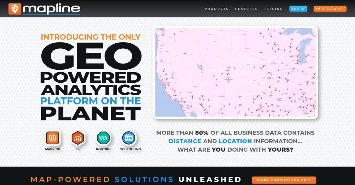
Mapline’s Geo Mapping and Geo BI features help you plot locations and visualize data in seconds from spreadsheets, offering quick insights. This means you can easily identify gaps and opportunities within your territories, improving strategic planning.
Here’s how Mapline allows you to see your data in a whole new way.
You can instantly transform complex business data into actionable visual insights. Mapline’s Geo Mapping and Geo BI products enable you to upload your existing spreadsheets and visualize locations and analytics on a map, so you can make informed decisions.
This powerful capability includes visualizing with charts, maps, and dashboards, offering robust analytics with reporting and monitoring tools. You can also leverage connectors and API integrations, and add geo-enriched data to enhance your existing information. Additionally, the Geo Scheduling feature assists with geographically smart in-field assignments, automating team calendaring while accounting for proximity, schedule, and skills to provide geo-optimized recommendations.
Gain clarity, optimize routes, and manage resources better.
Before diving deeper into Mapline’s capabilities, you might find my analysis of best audience response software helpful for collecting valuable feedback.
Key features:
- Geo Mapping: Plot locations easily from spreadsheets and visualize your data in seconds, with custom territory creation and management options.
- Route Optimization: Optimize routes, vehicles, and drivers, using smart simulations to avoid costly oversights and prioritize by drive time, revenue, or urgency.
- Geo-Intelligent BI: Visualize with charts, maps, and dashboards for analytics, reporting, and monitoring, enabling collaboration and centralized reporting.
Mapline features, pricing, & alternatives →
Verdict: Mapline stands out as a best location intelligence software solution, leveraging its proprietary geospatial engine to deliver powerful insights for sales, operations, marketing, and field services. With features like visual data analysis and optimized route planning, it can help you reduce operating costs and gain clear visibility into your business territories.
Conclusion
Location data should drive your growth.
Choosing the right tool feels overwhelming. With so many similar offerings, it’s tough for your small business to know which one delivers real value.
This is a widespread challenge for any growing enterprise. Precedence Research found a 22% increase in data enrichment efforts. Companies are actively investing heavily to turn raw spatial data into a true competitive edge.
Here is what I recommend.
Speaking of choosing the right software, my guide on best vendors management software will help you simplify your selection process.
From my review, Placer.ai is the top solution for your startup. It cuts through the noise by providing unprecedented visibility into foot traffic and market trends.
Its ability to track migration patterns and analyze industry reports is truly unmatched. I believe it’s the best location intelligence software for making confident, data-driven expansion decisions.
I suggest you try the Placer.ai dashboard for free. See for yourself how it clarifies your most critical strategic decisions.
You’ll gain a true competitive advantage.


